|
Suggested Locations for the Placement of Environment Canada's New Hydrometric Stations in the Georgia Basin |
| Title Page |
| Introduction |
| Data |
| Methodology |
| Spatial Analysis |
| Problems & Errors |
| Conclusion |
INTRODUCTION
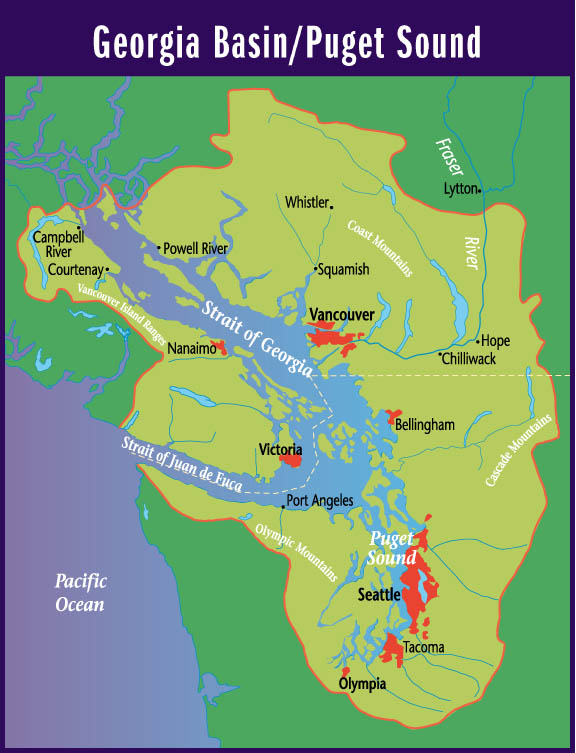
In April of this year, 2001, my first scientific paper, which I had written with my two Environment Canada co-op supervisors in 1997, was published, entitled, "Hydrologic and Climatic Zonation of Georgia Basin, British Columbia". In the development of this paper, we undertook a study to delineate zones where common hydrologic processes were active. We produced a map (Figure 2) which identified three regions where stream hydrology was driven primarily by winter rainfall, summer snowmelt, or a combination of the two. Hydrographs (Figure 3) illustrate these differences in hydrologic behaviour, in terms of mean daily discharge.
Data from thirty-seven hydrometric stations, meeting selection criteria, from throughout the Georgia Basin were analyzed. The development of the map involved interpolation amongst these individual sources of information and extrapolation from those areas with data to areas without. Where data were plentiful the delineation of the zones was done with confidence. However, large areas of the basin did not have hydrometric stations that fit the selection criteria, and our interpretation was based upon the existing data sources, so delineating these zones was more difficult and less precise (Wade et al. 2001). It was observed that hydrometric stations have a tendency to be located where it is convenient, near settlements and in valley bottoms. Most are situated in low-lying and/or coastal areas while inland and mountainous regions are under-represented (Wade et al. 2001). Thus, it is in such regions that there were fewer data and spatial interpolation was needed. Figure 4 shows the concentration of stations in the rainfall-dominated and transition zones.
Another important issue pertaining to the efficient and effective distribution of sites for a streamflow monitoring network in British Columbia is basin size (Rowntree at al. 1994). The study by Rowntree et al. identified a disparity in the distribution of drainage areas of hydrometric stations among major watersheds in B.C. Specifically, they discovered an unequal allocation of stations to each of the major watersheds and that some drainage classes were undersampled in certain watersheds. The Georgia Basin consists of three major watershed groups - Fraser, South Coast, and Vancouver Island (Rowntree at al. 1994, (1)). I created graphs of the distributions of Environment Canada's current ninety-four hydrologic stations' drainage areas, by watershed group, and also discovered under-representations.
Of course, in assigning stations to a given watershed, the size of the catchment area of the station depends on where the station is placed on the stream. The British Columbia Watershed Atlas (2) classifies watersheds not by drainage area, but by stream order. Intuitively, there is a positive relationship between basin size and stream order (3). Figure 6 plots the ninety-four stations and clearly illustrates that as stream order increases so does catchment area. I created graphs of the distributions of the Georgia Basin stations' stream orders, by watershed group. Again, there are classes that are undersampled in each major watershed. This analogy between catchment area and stream order leads me to believe that stream order could also be an important criteria in allocating stations for a hydrologic network.
From the observations of
the lack of stations inland, at high elevations, and/or in the snowmelt-dominated
hydrologic zone, as well as the underallocation of stations to certain
stream order classes in different major watersheds, stems my idea for this
GIS project. This project addresses this data under-representation issue
by suggesting new locations for Environment Canada's hydrometric stations
in the Georgia Basin. My analysis entails a multicriteria evaluation and
weighted linear combination of coverages of watersheds, hydrologic zones,
streams and transportation, and incorporates my own knowledge of the hydrology
of the Georgia Basin which I gained from my time with Environment Canada.
REFERENCES
Rowntree, S., R.M. Leith, N.L. Wade, and P.H. Whitfield. 1994. Application of RAISON to Spatial Interpretation of Hydrologic Data. Proceedings of GIS 1994. pp 729-734.
Wade, N.L., J. Martin, and P.H. Whitfield. 2001. "Hydrologic and Climatic Zonation of Georgia Basin, British Columbia." Canadian Water Resources Journal. 26: 43-70.
(1) Georgia Basin Ecosystem
Initiative
http://www.pyr.ec.gc.ca/GeorgiaBasin/images/maps/bg_watersheds.gif
(2) BC Fisheries
http://www.bcfisheries.gov.bc.ca/fishinv/basemaps-maps.html
(3) York University, Geog
111
http://www.yorku.ca/faculty/academic/arobert/14003.html