|
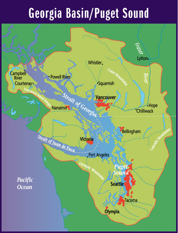
Suggested Locations for the Placement of Environment Canada's New Hydrometric Stations in the Georgia Basin |
| Title Page |
| Introduction |
| Data |
| Methodology |
| Spatial Analysis |
| Problems & Errors |
| Conclusion |
PROBLEMS AND ERRORS
This project went rather smoothly, I feel, without any major problems. My data, being from Environment Canada, was of pretty good quality and it seemed to be complete. For me, the biggest issue I had to deal with was MASSIVE amounts of detailed data. As I alluded to in previous sections, I had to convert, rasterize, and concatenate fifteen coverages for streams, lakes, and watersheds. This took forever and a day. The only coverage I truly struggled with was the DEM which required use of ArcInfo which is no longer in my repertoire (forgotten). One particularly frustrating aspect of using IDRISI is that there doesn't seem to be a way to delete more than one feature at a time. I spent a maddening amount of time eliminating hundreds of hydrometric stations and stream fragments outside of the Georgia Basin one by one. (Once in the image and again in the database!) Speaking of time, I spent over 100 hours on this project. No exaggeration. At one point, I was in the SIS lab for 24 hours straight.
Of course, no project in completely infallible and mine is no exception. I made note of the weaknesses I encountered in my data and how these weaknesses could ultimately impact the final result.
Since all of my coverages came from Environment Canada, their development was completely out of my hands. How well somebody digitized the hydrologic zones, streams, watersheds and roads might have affected the results I obtained. For example, I noticed in a couple of places in the streams coverage that some streams, which I could "tell" linked up with other streams did not - there were gaps. How well the hydrologic zones, (which were interpolated), and watersheds were delineated also would impact my final results.
Generalization was also a factor in my project. There cannot be an infinite (or even an unrealistically large) amount of data in a given coverage. For example, realistically, not every single trickle of water was digitized into the streams coverage. Someone somewhere made the decision not to include what was deemed to be insignificant. For the roads coverage, not every single road in the Georgia Basin was drawn. For example, in the Lower Mainland, no residential streets were included. Similarly for the DEM, at a 50-meter resolution, it is possible that there could be significant changes in slope within a single pixel. This would definitely impact the suitability of that area for a helicopter landing site. This could affect the outcome of my results.
The locations for new hydrometric stations could have been influenced by factors other than those I included in my analysis. For example, land use would be an important factor as to the suitability of where stations (or helicopter sites) could be located. (I assumed in my analysis that if a site was suitable for a helicopter and tree-covered, it could be cleared.) Proximity to towns and cities would have been a nice coverage to have. One could give preference to station locations by how long it took to drive from the nearest town. Paul Whitfield told me assigning stations by biogeoclimatic type or ecoregion are also possible things to consider. Of course, given how long it took me to work with the coverages I had, I do not regret not having those coverages! They would be an interesting project to explore in the future. (Maybe even Environment Canada could build on my project and use it to assist the design of their hydrologic networks!)
You might ask, if you haven't already, why did I not specify that new stations be a certain distance away from existing stations? The answer to that lies in the chaotic nature of hydrology. I hope that you have seen that even two stations that are close to each other can be sampling very different watersheds, in terms of catchment area and weather, and thus extracting different hydrologic data. Thus, it would have been an inappropriate constraint to use.
One issue that I am aware of but was unable to address in my project, (due to time constraints), is the issue of redundancy. It is one thing to find places for new stations, but what about existing stations that are providing redundant data? These stations could be moved from the redundant locations to the new locations, to save costs. I did not analyze which of the existing stations were redundant.
However, overall I was satisfied
with the outcome of my analysis, even with the knowledge of its weaknesses
in mind. I did not have to double back too many times to correct my methodology.
I gave a lot of thought and preparation into my rationale and reasoning
behind this project. I hope the viewer has come to realize and appreciate
this.