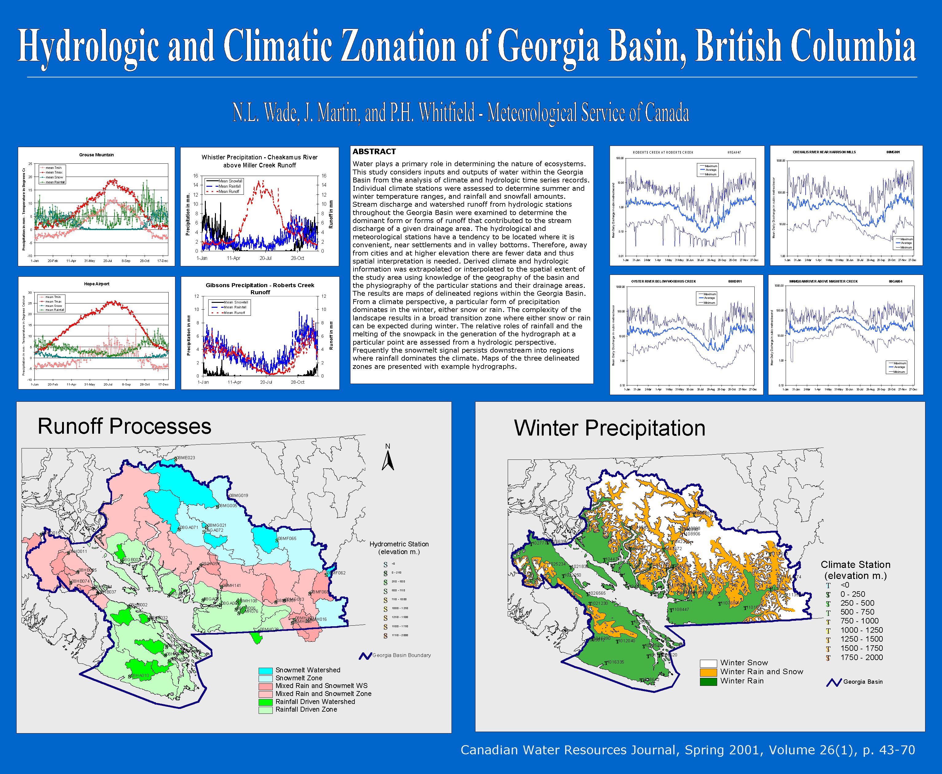
Figure 2.
Poster showing maps derived from research carried out in the paper, "Hydrologic
and Climatic Zonation of Georgia Basin".
The lower
left map illustrates the hydrologic zones. (See legend.)
(I realize
this image is way too big for the screen, but I wanted the viewer to be
able to see and read the entire poster.)