Methodological and Operational Problems:
Although great care was taken to minimize operational errors, much of the methodology conducted here was done under several assumptions in order to simplify analyses. The following is a summary of those assumptions that could not be avoided given the data available.
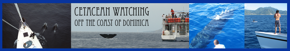
Sea State and Sightability : Generally, analyses of this kind would have normalized the data based on sea state. For many cetacean species, visual detection decreases with increased sea state. The environmental variables collected as a part of our sperm whale research are not sufficient to meet these requirements. This issue is compounded by the fact that directed research was being accomplished on sperm whales which undoubtedly affected the ability to sight other cetacean species in the surrounding area and biased our effort to following the whales. This is evident in the fact that even large groups of delphinids went unidentified as priority was given to the ongoing research. In addition, by not correcting for any of the following variables, we make the assumption that eye height, speed of the observation platform, and oberver experience and number, do not affect sighting rates. These assumption are often necessary when dealing with the small, sparse distribution dataset that exist for cetaceans (see Reid et al, 2003).
Temporal Variability: Cetacean sightings were pooled across four years of fieldwork and CW vessel tracks were pooled between two season. This assumes that patterns of cetacean abundance and distribution, as well as the distribution and intensity of CW effort, do not vary between months and across years. This is a bold assumption, that is unlikely to hold true. When the data were not pooled sample sizes within months or even within years were quite small making the analysis difficult, as is often the case with large pelagic species. In addition, tracklines were represented by point data for which each point represented 1 minute of effort; however, there were many situation in which part of a given minute was divided between two or more grid cells. For the sake of simplicity, the grid cell in which the point was located was attributed the entire minute of effort.
Data Deficiency: Working in the Caribbean often has its limitations in terms of data availability. Good bathymetric data would have been a useful asset when examining distribution of cetaceans. Unfortunately, none would appear to be available that were a small enough resolution to be accurate within my small study range. Another potential valuable source of information available to most areas of the world through remote sensing is surface productivity; which, used as a proxy for food availability, could have potentially been used to explain the hotspots of cetacean diversity. However, none of this type of data was available for the study area. Finally, little is known about the oceanography of the waters surrounding Dominica. There is no data on surface currents or major fronts which might have given some insight into distribution. Data deficiency is a problem in particular for Dominica. Even when data is available for areas in the Caribbean, it is often only so for the more developed islands, such as the US Virgin islands, Barbados, and the French West Indies (which incidently, bookend Dominica for which, surprisingly and frustratingly, no data would be available). Finally, the coastline data available is inaccurate, in that it overlaps with some of the trackline data when clearly the vessels were not going ashore. This was not a projection problem, but simply the best coastline data available for this island was only accurate to within a few hundred meters.
MCE: With only two factors to consider, the multicriteria analysis likely has little power. With more data on sea state, currents, and wind direction, a better friction surface could have been constructed for diesel use, rather than simplifying and using distance from port. In addition, the weighting of the factors was done based primarily on personal assumptions. As these weights affect the direct outcome of the MCE several were tested and most yeilded similar results which were slightly more conservative or biased depeneding on the exact values chosen.
Project Timeline: Given the time consuming nature of GIS analysis and the restrictive timeline of a single term course. I believe that the basis of this anlaysis are solid given the data and the timeline available. Most parts of the project went smoothly and with the discovery of DNR Garmin in late October, the rate of digitalization for the data increased dramatically, which was really the most difficult portion of this analysis. It would appear that behavioural studies, such as the ones I am undertaking for my doctoral thesis, are not conducive to the spatial analysis of cetcean distribution without major corrections and standardization based on data which was unavailable here.
The Bright Side : Having said all of the above, the up side of the project is that the basics have been established for future analyses. My doctoral project will continue for two more seasons, at which point I hope to revist this analysis. In addition, the association of CW operators, CARIBwhale, are attempting to begin systematic collection of sightings data from all members from across the Caribbean; as well as, mandating GPS units onboard all vessels. This will allow for a more comprehensive analysis of CW effort and cetacean distribution in the neat future. What is important is that this may be the first study of this kind for an area for which very little is known for any of these species, and as discussed background data on distribution and abundance is always difficult to come by. So, if nothing else, this analysis will serve as a snap shot of CW vessel effort and cetacean distribution and abundance for an area where, given the current lack of data, even the most rough estiamtes are important for conservation and management decisions.
Continue to References