USING IDRISI AS A DECISION SUPPORT GIS
Rationale and Methodology
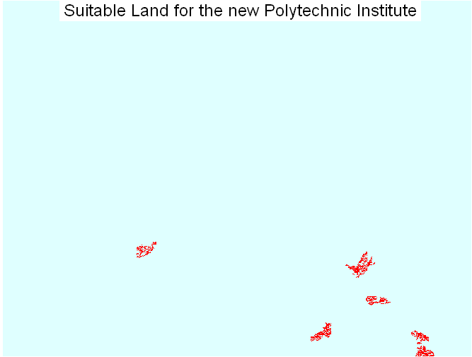
The location of the school in the Greater Vancouver Regional District is influenced by a number of constraints:
4.The campus needs to be on mostly flat area, no more than 2.5 degrees of slope, and south facing.
5.The campus requires at least 1.5 square kilometers in area.
IDRISI layers representing these areas are processed to produce a map that represents the areas potentially ready for the establishment of the new polytechnic institute.
Copyright © Nicholas Y. L. 2008
Department of Geography
Simon Fraser University