USING IDRISI AS A DECISION SUPPORT GIS
Constraint 5 and Spatial Analysis
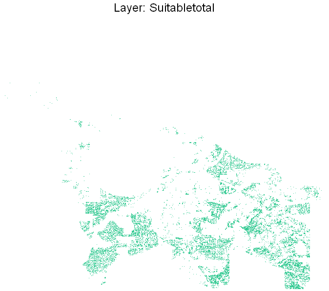
The five layers created, AVAILAND, NEARHWY, AWAYBCIT, SOUTHFACE and FLATGRD are overlayed in the IDRISI macro modeler, to produce the following: a layer called SUITABLETOTAL that represents all the areas that satisfy the requirements.
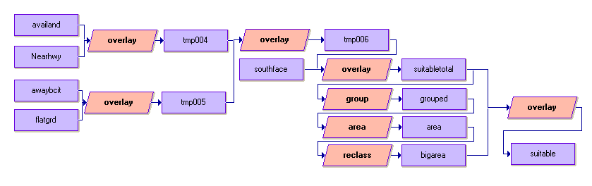
They are then grouped using the module GROUP, to group together those cells close together. And using the module AREA, the areas are calculated. RECLASS is used to assign a value of 1 to areas that are more than 1.5 square km in size and 0 to those that are smaller than 1.5. Finally, overlay is done again to exclude the large area that does not satisfy the requirements. The following is the macro model.
Running the model produces a map representing the desirable areas for the new polytechnic institute. Layer named suitable.
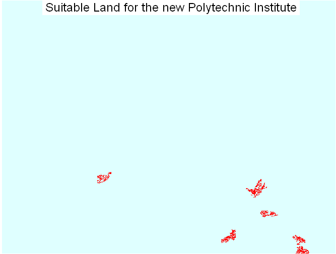
Note that there is five major areas (indicated by the color red). Which one is the best?
Copyright © Nicholas Y. L. 2008
Department of Geography
Simon Fraser University