USING IDRISI AS A DECISION SUPPORT GIS
Constraint 1 - Developable Zones
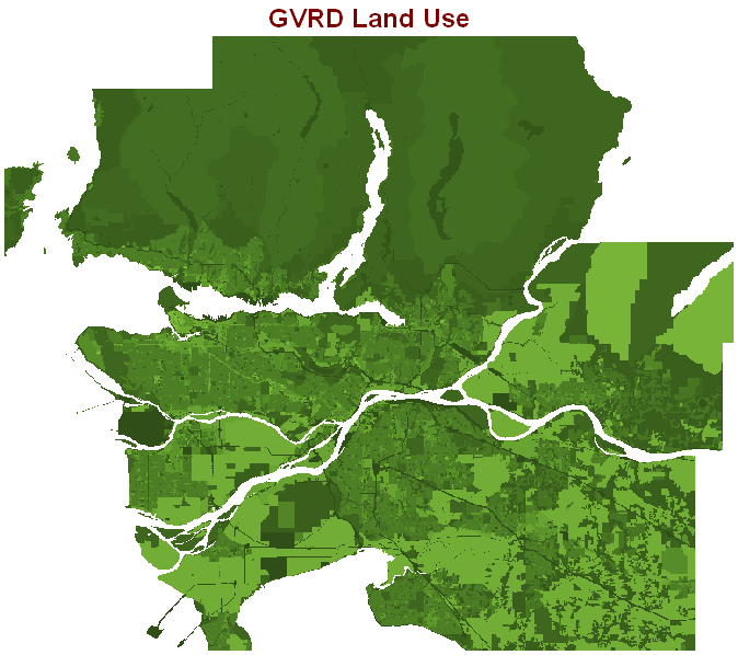
The GVRD Land Use layer (lu_2001) is adjusted to a workable size by using the module WINDOW in IDRISI, the new data layer is now called GVALU. It contains data about how land is used in the Greater Vancouver area.
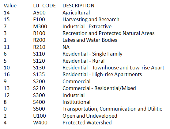
The file’s metadata indicates the values associated with each type of land use.
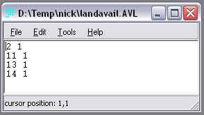
An attribute values file (.avl) is created to indicate the new numbers to be assigned to the current values. 1 is available for development and 0 is unavailable.This file is named landavail.avl.
Using the module ASSIGN, a new layer is created to indicate the land that is available for development. This layer is called availand.
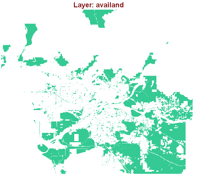
This layer shows areas that satisfy the first requirement that only agricultural land, mixed commercial/residential areas and undeveloped zones are to be considered.
Copyright © Nicholas Y. L. 2008
Department of Geography
Simon Fraser University