Data Collection
The GVRD 50m resolution DEM was imported into IDRISI by converting the ArcMap raster file to a .flt intermediate format which was then imported into IDRISI using the ARCRASTER operation.
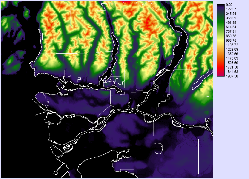
GVRD 50m resolution DEM
Data processing and editting of population information tables were done in ArcMap. Population statistics for each dissemination area was retrieved from the U of T Census Analyzer for the year 2006. This information was placed into a table which was joined to the 2006 Canada Census boundary map from the SIS Data Warehouse. Since the census map did not contain boundaries involving rivers, lakes and other water bodies, the map was clipped with a map of the municipal boundaries also from the Data Warehouse, which included borders for water bodies to obtain correct areas for each dissemination area. Area was then calculated using the 'Calculate Areas' tool. As the spatial resolution of the GVRD DEM is 50m, the 50m population density of each area was calculated to determine the approximate number of people represented by each cell. The population map was then imported into IDRISI as a vector. The 50m population density field of the table was exported into its own layer and converted into a raster by matching the spatial attributes in the GVRD 50m DEM.
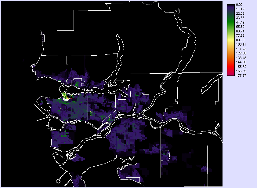
GVRD Population Density per 50m Cell
Streams and other water sources in the GVRD (water) were from the SIS Data Warehouse as well. This was imported into IDRISI as a vector and converted to raster.
Bedrock and faults were both from the Geospatial Download section of the Ministry of Energy, Mines, and Petroleum Resources website. These were both projected into the UTM Zone 10N projection which is used in this project, and then imported into IDRISI as vectors and converted into rasters matching the GVRD 50m DEM. Bedrock age and type were the two columns used when creating raster files from the vector shapes.
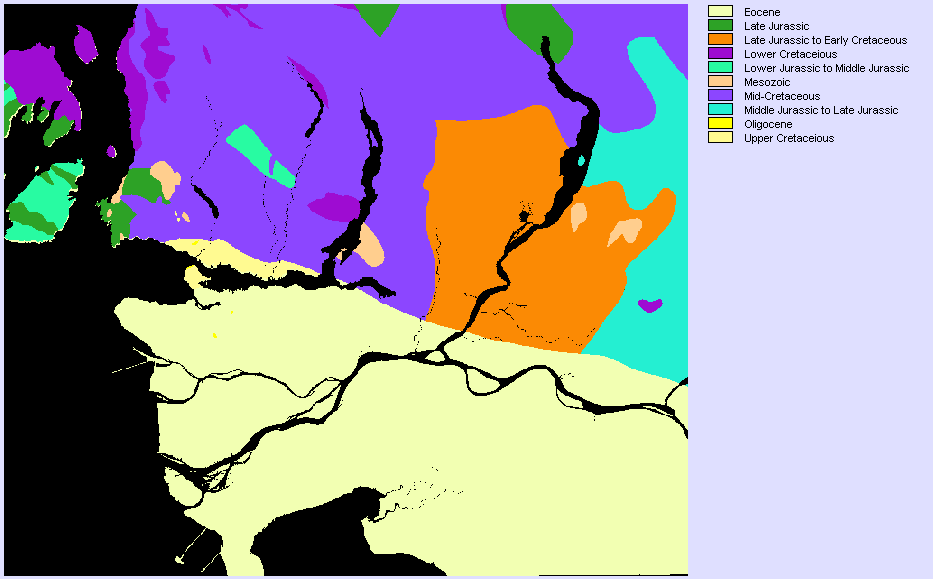
Bedrock Age
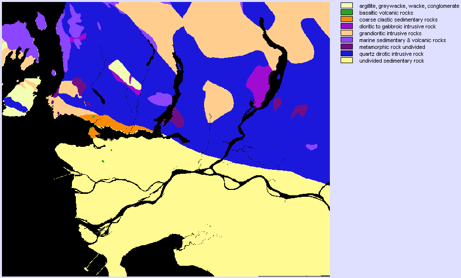
Bedrock Type
Lastly, 1995 surficial data for the BC from the GeoBC Data Distribution Service website, was imported into ArcMap as a shape file, and then imported into IDRISI. The categories in the map as described in the definition file are:
| 1 | A | 'Alluvial Deposits','stratified silt, sand, clay, and gravel; floodplain, delta, and fan deposits; in places overlies and includes glaciofluvial deposits' |
| 2 | Gp | 'Glaciofluvial Plain','sand and gravel; deposited as outwash sheets, valley trains, and terrace deposits' |
| 3 | Mv | 'Lag (Glacio)Marine','sand, gravel, and pockets of finer sediment; thin to discontinuous sediment veneer and residual lag developed during marine submergence; includes areas of washed till and rock' |
| 4 | Ra | 'Alpine Complexes','rock, colluvium, and till; rock and Quaternary deposits complex in an area, characterized by alpine and glacial landforms' |
| 5 | Tv | 'Till Veneer','thin and discontinuous till; may include extensive areas of rock outcrop' |
| 6 | cM | 'Coarse grained (Glacio)Marine','sand and gravel; deposited as sheet sands, deltas, and extensive flights of beaches' |
| 7 | rC | 'Colluvial Rubble','rubble and silt; derived from carbonate and consolidated fine clastic sedimentary rock substrate' |
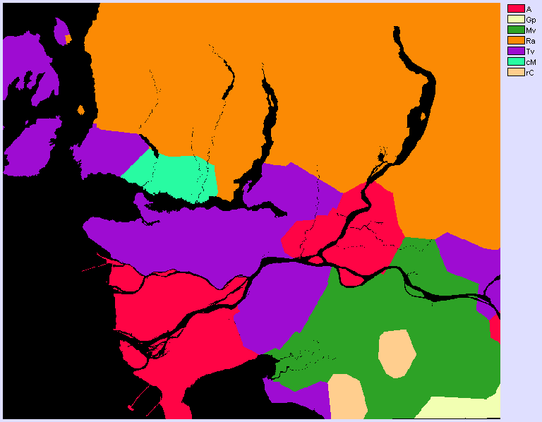
Surficial Material