Spatial Analysis
Earthquakes
The Multi-Criteria/Multi-Objective Decision Wizard was used to determine areas most at risk from earthquakes. Two factors and one constraint was used to form the objective. A raster of the GVRD with all land areas set as 1, and water areas as 0, was used as a constraint to limit results to land areas only. The two factors used were the distance from fault lines, and the liquefication potential. FUZZY was used to scale each factor to fit between the range of 0 to 255.
For the distance from fault lines, the membership function shape was set to monotonically decreasing, and the membership function type as J-shaped. The reasoning for this was that the intensity of a earthquake decreases exponentially with distance from the epicenter. Control points used were 0 for c, and 17704.4 - half of the maximum distance, for d.
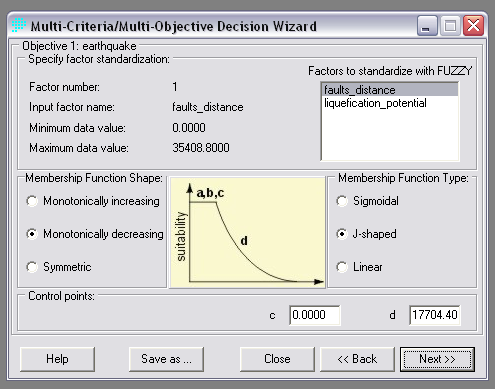
Settings used for factor standardization for distance from fault lines
A monotonically increasing membership function shape and linear membership function type was used for liquefication potential. As I wasn't sure of how much a change in liquefication potential would affect the amount of damage caused by an earthquake, I felt a linear function would be the safest assumption. Control points used were 0 - the minimum value, for a, and 28 - the maximum value, for b.
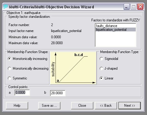
Settings used for factor standardization for liquefication potential
Respective weights of 0.33 and 0.67 were used for the distance from fault lines and liquefication potential. Liquefication potential was determined to twice as important as the distance from fault lines for this analysis.
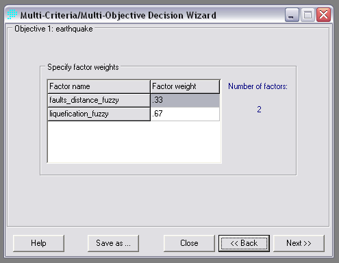
Weights used for determining risk of earthquakes. Liquiefication potential was given priority in this analysis.
Landslides
The MCE/WLC wizard was again used to determine the risk of landslides within the GVRD. The shape of the land area was used for a constraint, and slopes, distance from streams, distance from faults, and resistance of underlying bedrock from weathering was used as factors. FUZZY was applied to all factors in order to standardize them to the ranges of 0 - 255.
A monotonically increasing membership function shape and sigmoidal membership function type was used for standardizing the angle of slopes. Control points of 0 for a and 37.1846 - half to maximum slope, was used for b.
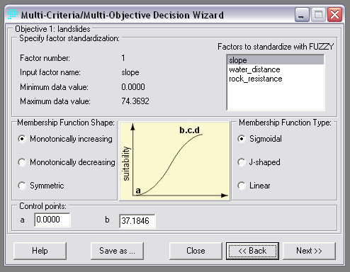
Settings used for factor standardization for angle of slopes
The same settings were used for distance from fault lines as in the earthquake analysis, no further steps were required for it, the FUZZY output from the earthquake analysis was reused in this analysis.
For distance from rivers and streams, a monotonically decreasing membership function shape and J-shaped membership function type were used for determining the extent of effect water would have on landslides. The control point c was assigned a value of 0, and d was set as 500. 500 was chosen as the maximum distance for an area above ground water would affect.
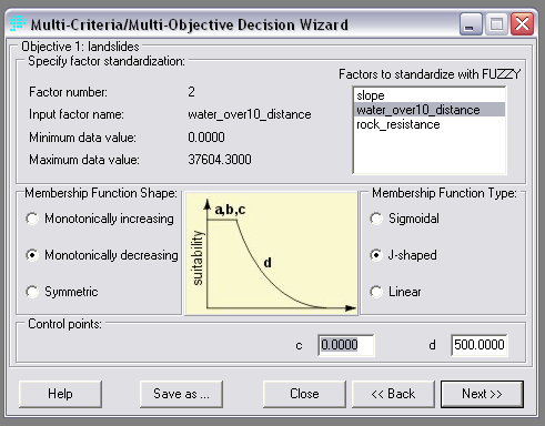
Settings used for factor standardization for distance from rivers and streams
Bedrock resistance to weathering used a linear monotonically increasing function to standardize the data. The beginning and ending control points were set at 0 and 4.
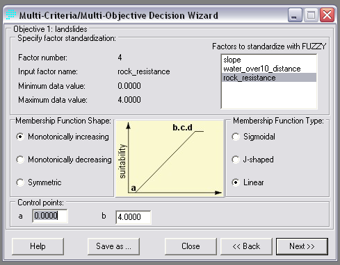
Settings used for factor standardization for rock resistance to weathering.
As slope was considered the most important factor in landslides, it was assigned a weight of 0.5. The remaining 3 factors were each assigned a weight of 0.1667.
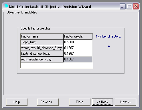
Weights used for determining risk of landslides. Slope angle was given high priority in this analysis

