|
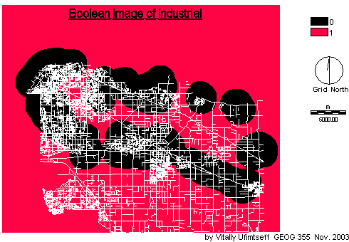
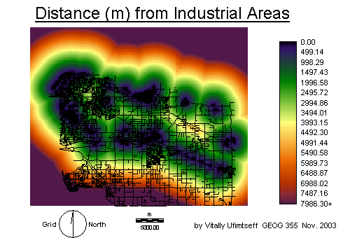
Industrial areas were chosen due to several factors. These included chemical and noise pollution. Transporation areas were those areas including major road or railway networks. These included all major road networks Highway 1, Highway 99 and the railroads (like Canadian National, Canadian Pacific, and BC Rail). Obvious reasons include heavy traffic volume and noise pollution.
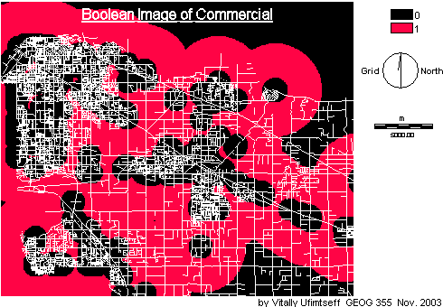
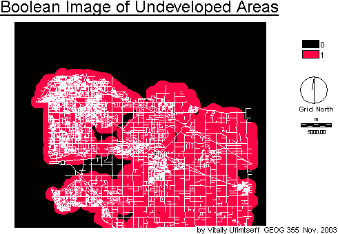
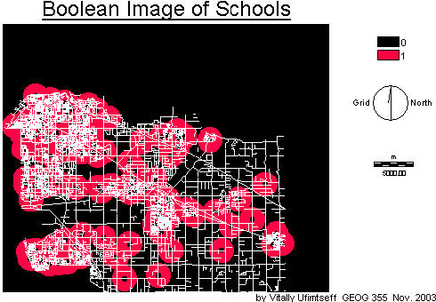
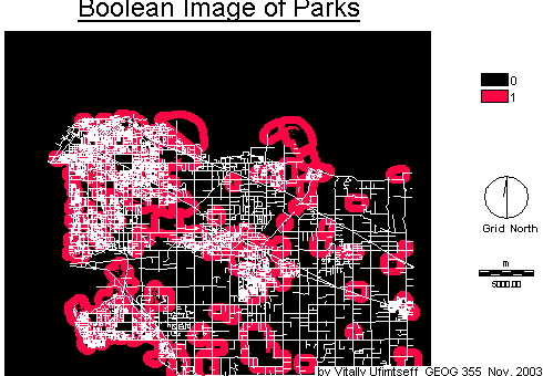
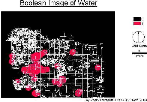
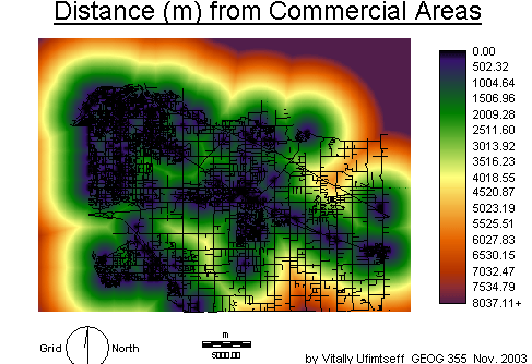
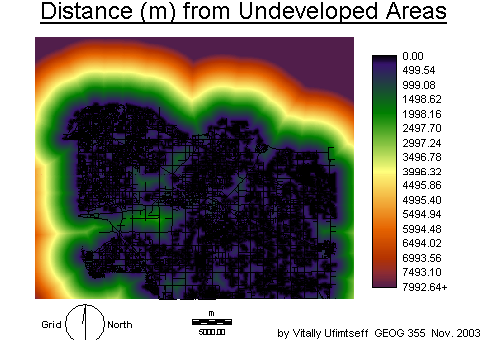
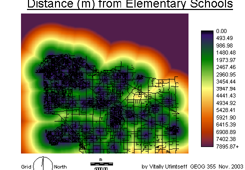
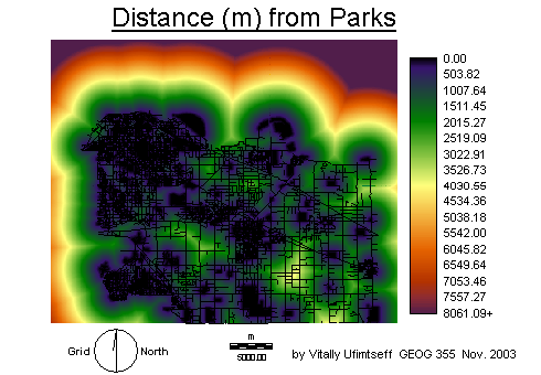
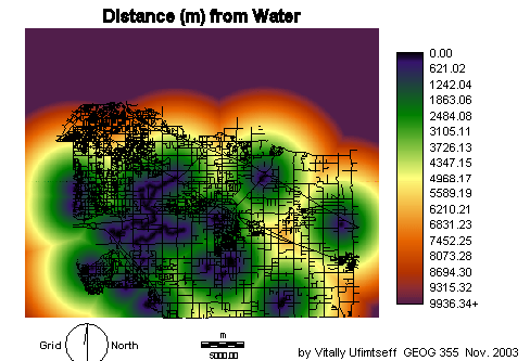
For the other five criteria, the logic is as follows. Commercials areas were preferred to be nearby but not closer than 1000 metres due to heavy traffic volumes and noise. However, they were to be close enough so as to be convenient for shopping purposes. Undeveloped areas were chosen as a factor because they were open areas away from any other current development. This allows some privacy in regards to proximity to other people. Elementary schools were chosen because of family reasons. Not only am I planning to be an elementary school teacher, but my wife and I are considering to start a family in the near future. Hence, being near an elementary school is ideal as it will become quite convenient for both parents and the children. Parks were chosen because it is nice to have one nearby for walks, picnics and also because they act as a buffer from other factors like commercial, industrial and transportation areas. I chose water as a factor for the similar reasons I chose parks. I think it is nice to live near rivers, creeks, streams, or lakes although the Fraser River was not considered as an ideal place for this project.
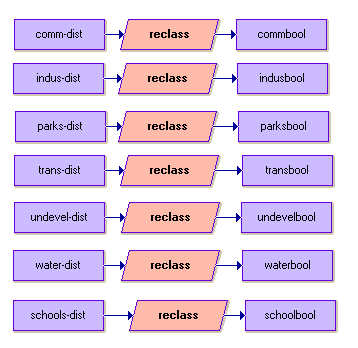
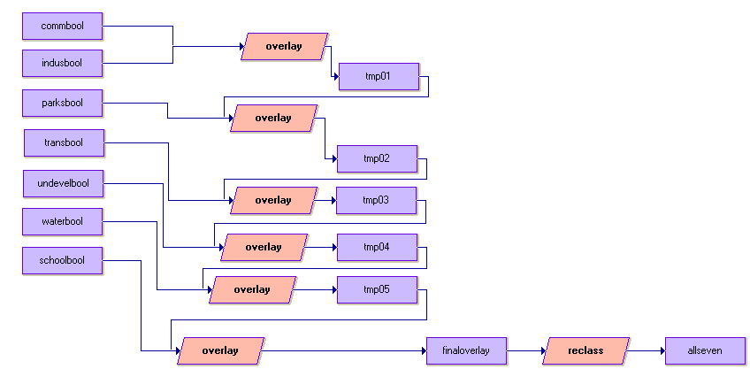
Using the Macro Modeler, the raster images were converted from vector format using the module's POLYRAS, LINERAS, and POINTRAS. I then took the raster files and used the DISTANCE module to create a new layer showing the distance values for each of the criteria
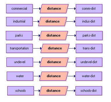
The following images were the result of the DISTANCE module:
 |
|
 |
 |
 |
 |
 |