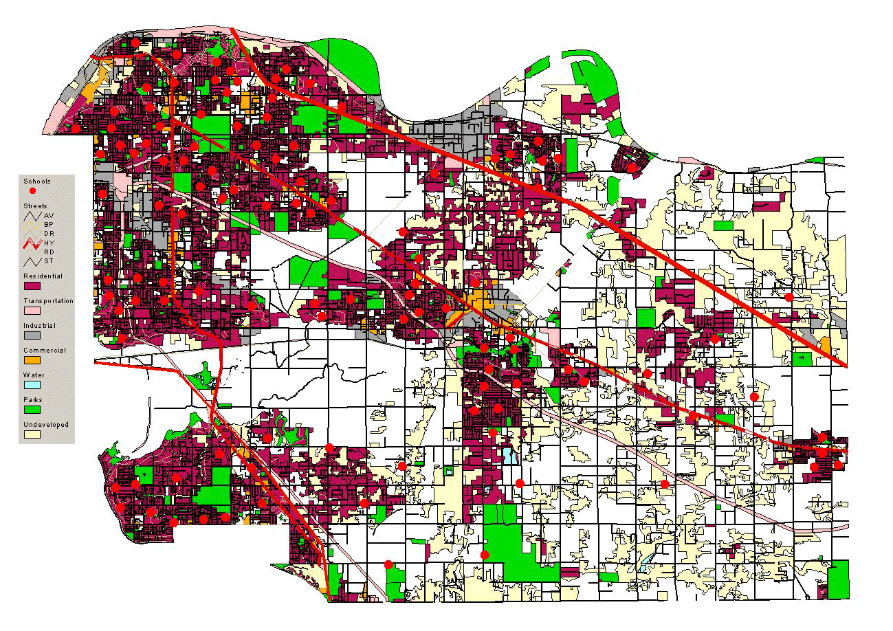
Initially, I opened the 2001 landuse shapefile in ArcView and added the
street networks and municipality boundaries. After creating two
shapefiles named Surrey and Langley, I used the Geoprocessing Wizard
and clipped the landuse and street shapefiles based on these municipal
boundaries. The following is a list of the shapefiles created:
The schools shapefile I digitized myself after referring to online maps from the school district's webpage - namely, School District #35 (Langley) and School District #36 (Surrey).
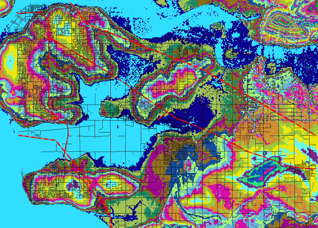
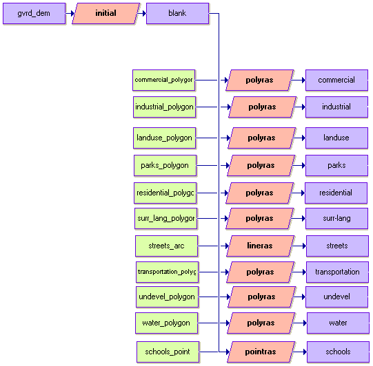
After all of the shapefiles were completed, I converted them into IDRISI Vector Format using FME 2003 X2. The projection used for the base files was UTM83 Zone 10 and was maintained in the translation for all files. Using IDRISI Kilimanjaro, all of the above-mentioned files, once in IDRISI vector format, were converted into raster format using the Macro Modeler.
(click on images to enlarge)
|
 |
 |
The schools shapefile I digitized myself after referring to online maps from the school district's webpage - namely, School District #35 (Langley) and School District #36 (Surrey).
After all of the shapefiles were completed, I converted them into IDRISI Vector Format using FME 2003 X2. The projection used for the base files was UTM83 Zone 10 and was maintained in the translation for all files. Using IDRISI Kilimanjaro, all of the above-mentioned files, once in IDRISI vector format, were converted into raster format using the Macro Modeler.
 |