[Index] [Project Home] [Conceptual Outline] [Cartographic Model] [Data Collection] [Methodology] [Spatial Analysis]
Some operational problems that were encountered with this project included:
1. Proper reprojections of the data. The data that was received by TransLink had no metadata to tell what projection the vector data was in. When I attempted to contact David Murray from TransLink who was very kind in providing the data for me, he was unavailable or may not have received my emails. When the Idrisi vector format of the Skytrain and Skytrain Stations were added on as layers to the GVRD landuse raster file, the line and stations lined up to where they should of be located. Therefore layers were projected to UTM-10N NAD 83 as that was the projection for the GVRD landuse data from the S:/ drive. Going through this aspect made me realize just some of the problems with attaining data that doesn't have metadata. As a result, any analysis is questionable as the information it portrays may be skewed or incorrect.
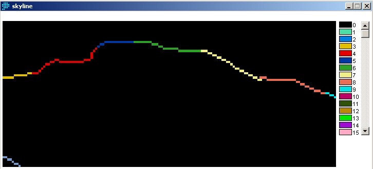
2. Conversion. With the changes from a vector format to a raster format, shapes of lines are not easily maintained, especially if the lines are not straigt and curve a lot, such as the Skytrain Line. Not only do the pixels affect lines, but they also affect the land use layer as land use is not set in blocks but is more of a freeform attribute.
Above: A raster layer of the Skytrain Line. You can notice the blockiness of the line due to the pixels that is used to display raster data.
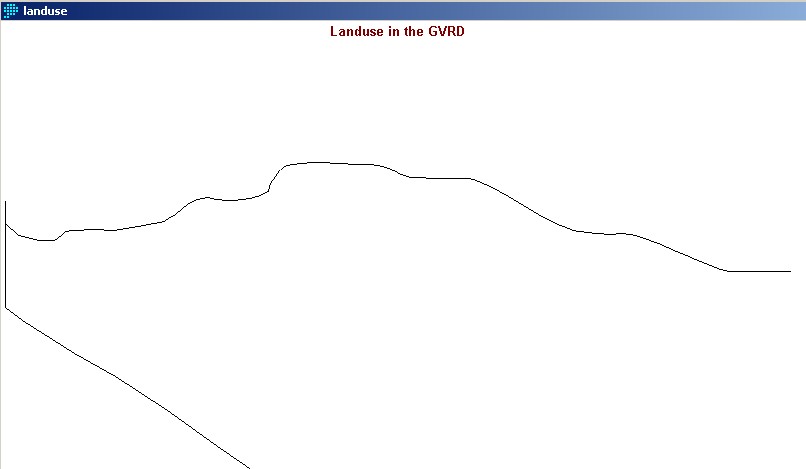
Below: A vector layer of the same section of the Skytrain line. You can notice how the line is much smooter than that of the raster version.
3. Inexperience. For the most part during this project, I felt like I was fumbling around with the program (similar to what I felt when doing my GEOG 354 project in ArcView). I think that if I had more experience, I would be able to accomplish more in terms of spatial anaylsis.

Pierre Lueders and Dave MacEachern
show off their Gold Medals attained in the two-man bobsled event.
Hopefully I'll be as happy
as they are with my mark for this project . . . but we'll see.
Think you're done? Almost.
[Index] [Project Home] [Conceptual Outline] [Cartographic Model] [Data Collection] [Methodology] [Spatial Analysis]