Methodology - Land proximity factor
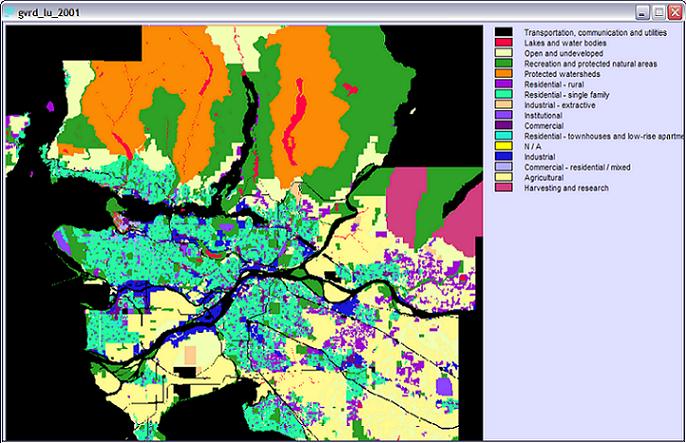
The original GVRD landuse image (gvrd_lu_2001.rst)
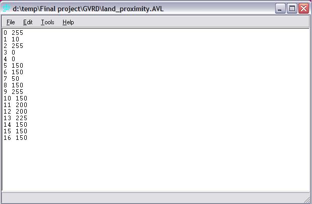
Before using the 'assign' module to reassign new values (or 'fondness scores of airport proximity) to all landuses, it is necessary to use the 'edit' function to create a file (.avl) that contains the new scores and landuses. The numbers in the left column represent the codes of landuses, whereas those in the right column represent new values (0 = the lowest score / complete dislike of airport proximity; 255 = the highest score / complete fondness of airport proximity).
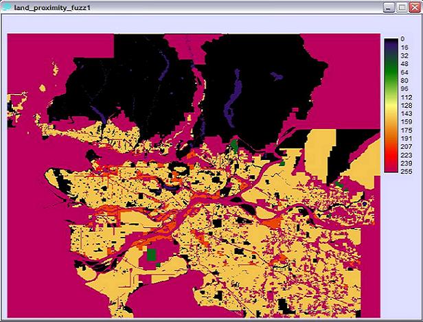
Using the 'assign' module, the original landuse image transforms to represent landuse proximity to airport.
Back: Methodology