

Cartographic Model displaying the development process of the two constraints for the MCE 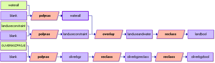
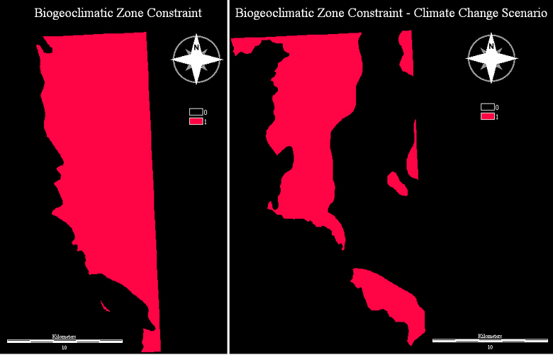
The reason for the overlay used in the development of the landbool (landuse constraint) was because the landuse and waterbodies were separate images initially that needed to be combined using the overlay module(addition function) to account for landuse including water bodies. Furthermore, the above model for the constraints criteria outlines the process used to develop the land and biogeoclimatic zone constraints outputs. However, it is important to note that in the Early Spring and Late Summer MCE's, the constraints were exactly the same. In the case of the Climate Change Scenario, the biogeoclimatic zone was reclassed to take into account changes in biogeoclimatic zones as temperatures increase. The final reclass pushed the suitable areas to higher elevations while the original areas of suitability were now considered unsuitable as conditions were assumed to decline (increased water stress, increased temperatures, evaporation of lower elevation ponds). These differences can be seen in the following figure which compares the biogeoclimatic zone constraint under each condition.
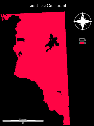
The output to the left shows the land-use constraint used in all scenarios (Early Spring, Late Summer, and Climate Change Scenario). Increases in population growth and development expansion were accounted for in the factors by altering the level of suitability or distance from urban areas. In this case, the urban zone that was considered unsuitable was increased arbitrarily.