Spatial Analysis
The spatial analysis consisted of a multi-criteria evaluation using several constraints:
-Community agricultural initiatives could not be in parks
-Community agricultural initiatives could not be in green city project areas
-Community agricultural initiatives could not be on roads
-Community agricultural initiatives
could only be in low income neighborhoods (Kensington-Cedar Cottage, Renfrew-Collingwood, Killarney, Mount Pleasant, Strathcona, Grandview-Woodlands,and Hastings-Sunrise)
-Community agricultural initiatives could only be in the following land use areas: multi-family dwellings, two family dwellings, one family dwellings, comprehensive development, and limited agricultural zones
*family dwellings were included as backyard gardens, edible landscapes, and urban farms in backyards were counted towards urban agriculture projects.
Making a series of boolean maps and overlaying them with one another a final map was produced:
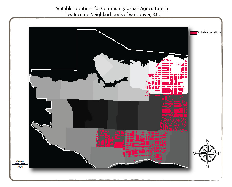
There are a number of locations on the east side of Vancouver that may be suitable for community agricultural initiatives. Many of the suitable locations are in residential areas, so the promotion of edible landscaping or allowing an urban farm to grow in backyards, such as the Sharing Backyards program, would be the best choice for residents in these regions.