Methodology
Almost all of the constraint files that I acquired were in ESRI shapefile format and had to be converted to raster files using the conversion tools in ArcMap 10.1, for example:
1) city boundary --> conversion tools --> to raster --> polyline to raster
Files Converted to Raster
*street raster is missing
This was done for each of the shapefiles acquired through the City of Vancouver Open Catalogue, using either polyline to raster or polygon to raster.
Once the shapefiles were converted to raster format, they were converted in ASCII files so that they could be imported into IDRISI. The raster to ASCII tool was used in ArcMap 10.1, and then were imported into IDRISI:
File --> Import --> Software Specific Formats --> ESRI Formats -->ARCRASTER
The kml. file was imported directly into IDRIS and converted into a vector file using the following method:
File --> Import --> Desktop Publishing Formats --> KMLIDRISI
Once the kml. file had been converted to vector, the projection was changed from Lat.Long to UTM 10N using the module project. The vector file was then converted to raster using the module POLYRAS:
Unfortunately, the data that had been imported into IDRISI would not overlay due to differences in rows and columns, and each one had to be resampled using the module RESAMPLE, using citybound.rst as a reference.
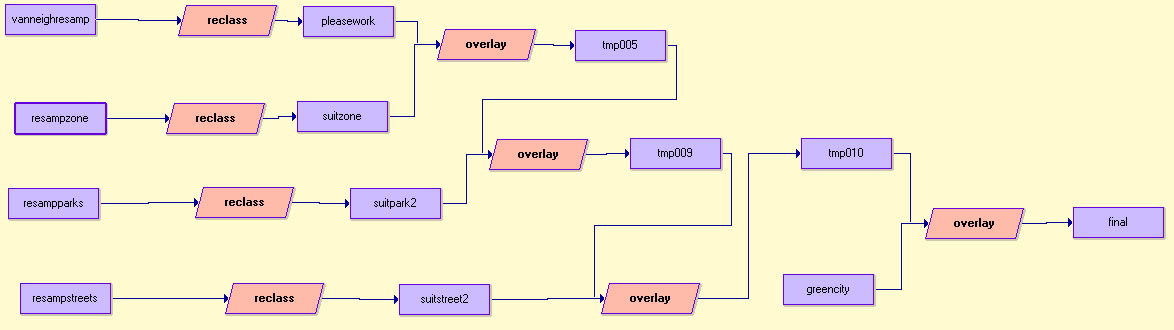
The rest of the methodology is shown in the following macro modeler:
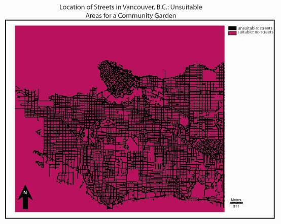
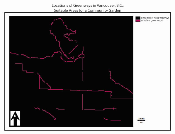
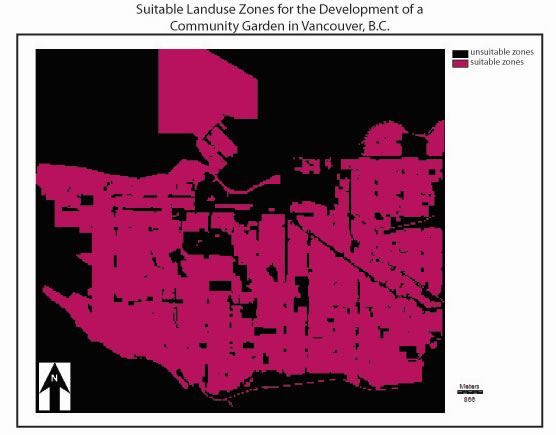
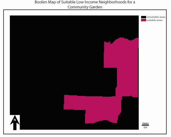
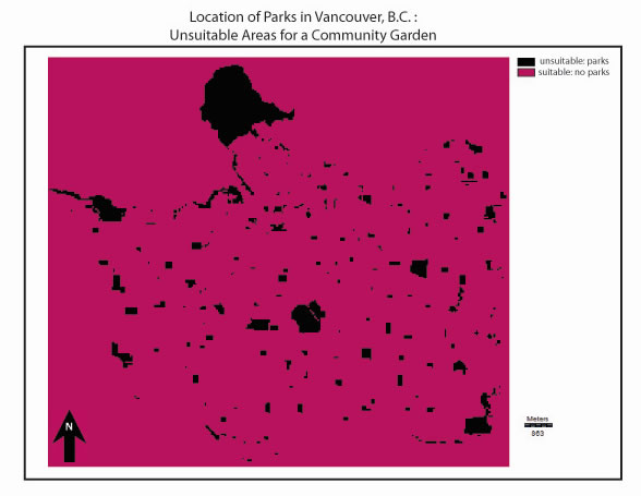
The resulting boolean maps followed: