 |
|

IntroductionCreated by Michael Peterman for Geog 355, Fall 2003. Email: mrpeterm@sfu.caThis project was created to assess two types of volcanic hazards from Mt. Rainier: lahars (eruption-initiated mudslides) and pyroclastic surges (hot, debris-laden shock waves). Mt. Rainier is generally considered the most dangerous of the Cascade volcanoes. Since the eruption of Mt. St. Helens in 1980, disaster planners have become aware of the potentially severe effects of volcanically-induced mass movements. Several hundred thousand people live in the Mt. Rainier watershed, and a number of communities (such as Tacoma) are built on previous volcanic deposits. Using a digital elevation model for the study area (click for map), I have applied a series of steps to create a hazard surface for lahars and pyroclastic surges. The resulting hazard maps can be used to visualize potential impacts on specific communities and pieces of infrastructure, and can serve to guide public policy in land-use planning. 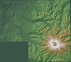
But first, look at a visualization of the area Next: Background >> |