Methodology
Identification of important factors in volcanic hazard assessment
Volcanic hazards from Mt. Rainier were divided into two categories: lahars and pyroclastic surges.
The first, lahars, are large masses of water, volcanic debris, and surficial debris flowing down the slopes of a volcano and into surrounding river valleys as a result of an eruption. In the case of Mt. Rainier, lahars are expected to be especially large, because of the huge amount of water available in glacial ice near the summit. After melting catastrophically, the glaciers would introduce a huge amount of water to the local hydrological system.
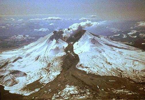
Lahar on Mt. St. Helens, 1982. Source
Lahar hazard analysis is based on several factors.
- Horizontal distance from river channels. With increasing distance from a river channel carrying a lahar, hazard is reduced.
- Vertical height on a valley side above a lahar channel.
- Distance from Mt. Rainier. Since debris-laden lahars will likely exceed the carrying capacity of the stream channel, deposition will occur along the length of the channel and friction will slow the lahars on relatively flat terrain. Essentially, distance from the summit acts as a proxy for friction acting on lahars moving downslope.
The second factor, pyroclastic surges, are high-speed, low density flows of volcanic material that propagate outwards from an eruption column. These surges are composed of superheated gases and particulate matter, and can reach speeds of 1000 km/hour and travel up to 30 km from their source (depending on terrain). The flows can travel up and over topography, but they lose kinetic energy with distance from the volcano and usually collapse within 10 km.
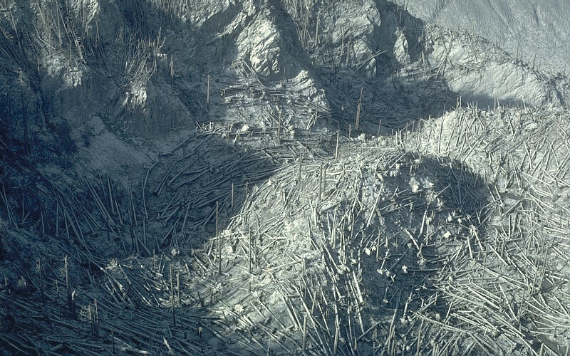
Trees burned and felled by a pyroclastic surge from Mt. St. Helens, 1980. Source
The hazard from pyroclastic surges is based on two terrain factors.
- Distance from the eruption site (assumed to be the summit)
- Orientation relative to the summit. Slopes oriented towards the summit of Mt. Rainier are more at risk for a direct hit by a pyroclastic surge. Slopes oriented away from the summit have a lower risk.
Of these two factors, distance is more important, especially since pyroclastic surges can travel up and over terrain.
Analysis  Results & Discussion Errors References Results & Discussion Errors References
|