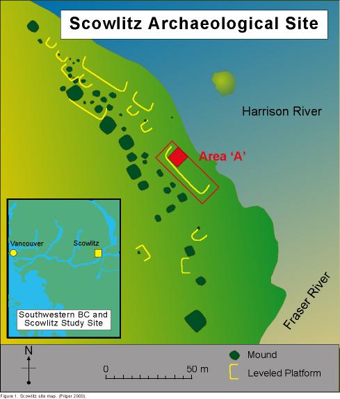
Figure 1. Scowlitz Site Map
Archaeological evidence indicates that large portions
of the area had been leveled to allow for
the building of cedar plank houses. Many features of these settlements,
notably post holes, hearths
and fire pits can still be found.

Figure 1. Scowlitz Site Map
Once an area is selected for archaeological excavation,
a datum, or reference point is established
to which the smaller working grids are referenced. The datum is usually
arbitrarily set within the
context of the overall site. The master datum is given coordinates
of 0,0, and an arbitrary elevation
(eg. 100 meters). From this point the area is cordoned off into
a grid using total station surveying
equipment for which additional site-specific datums are placed in reference
to the original. From
these, subsequent smaller grids are overlain which traverse the area
laterally, and once excavation
begins, vertically as well.
For our group's study area, we used datum "A", established
in 1992 by the University of British
Columbia. These areas were excavated in 1997 and 1998 by Simon
Fraser University.
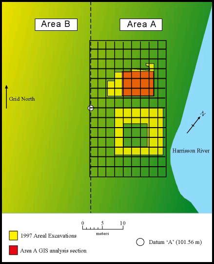
As can be seen in Figure 2, the north-south axis
of this grid roughly parallels the Harrison River
at a bearing of 43.5 degrees west of magnetic north as of 1992.
From this grid reference system,
x, y, and z values for any feature in the excavation pit could be logged.
Z represents subsurface
depth, which can be correlated with time of deposition for the various
features.

Figure 2. Site Datum and Grid
The features of importance for this study were those
lying within sub-surface, horizon 3. It is
believed that the features found at this depth, or time, represent
the greatest change in occupation
and development for the Scowlitz people. By using correlation
by association a rough estimate of
the relative age of any feature can be established. Linking features
which lie throughout this depth
horizon with features that may be found in future neighbouring plots
is known as dating by
association.
Deposits at the site were excavated primarily by
trowelling. Deposits were designated and
removed, by arbitrary 10 cm levels, within identifiable stratigraphic
layers. Each new layer was
recorded in a layer log, with the assigned and logged identification
number used in all subsequent
references to that layer within the excavation area.

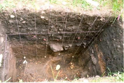
Photo 1. 10 cm Strata layers for excavation pit.
Accurate recording of coordinate values for any feature
is of paramount importance when
conducting an archaeological survey. Errors, especially within
the Z values, can result in a
given feature being inaccurately dated. In addition, inaccurate
measurements can result in the
overlapping of features.
Horizon 3 is indicated in this test pit (Photo 1)
by the change in soil types, visible by colour
change banding. The particular depth at which we are operating
is believed to be one of change for
the coastal Salish (Scowlitz) Nation. In essence we are pulling together
snapshots in time to establish
a connection between the changing settlement patterns exhibited by
these people and 3-dimensional
mapping of the features and pits have been conducted.
Introduction/Background/Site/Methodology/Analysis/Discussion/Links/Home