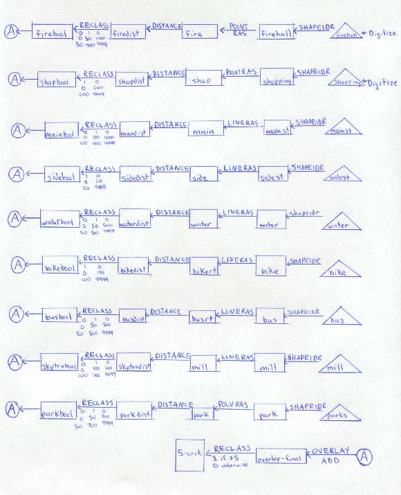
Here is the cartographic model for this project. The
first image is of the initial setup, and the Boolean overlay analysis:

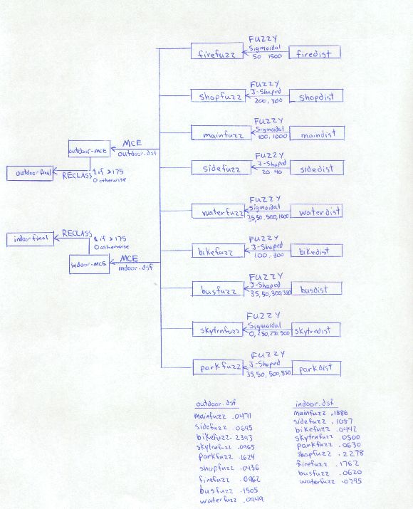
The second image is the model of the MCE analysis and the FUZZY rescaling:

The second image is the model of the MCE analysis and the FUZZY rescaling: