Data Sources and Accuracy


albersUS Pop
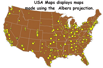
To start the project I acquired US census data from 2000 - 2001 in shape files. After doing some ArcView manipulation (removing Alaska and Hawaii locations) I imported them into Idrisi. A comment on accuracy here is it seems the US like to 'dither' the census information as suggested in section 8-3 of the accuracy disclaimer document provided as meta data. Conversion to a raster format with a suitable scale measurement was accomplished with idrisi and Albers projection. Assigning the id codes of the data set to the values of the points in the raster image.
All other data like team location, attendance records, time zone, financial, etc., were obtained and input manually. Since I am a student with no pay this suggest a high incidence of  input errors. Hopefully my technical knowledge and desire for a good mark can compensate for the previous handicap.
The jewel in the crown of my data acquisition was the financial report given out by the NFL, which as a private company does not have to make public these records. Searching for this bit of knowledge caused much strife in my life.


Links to Sources


Census Bureau (TIGER data)

US Census 2000
http://www.dollarsandsense.org/archives/2000/0300eitzen.html
    enlightening report on the schemes of professional sports teams

http://www.NFL.com/
http://www.NHL.com/
http://www.NBA.com/
http://www.MLB.com/
    team locations and fan base

http://www.infoplease.com/ipsa/A0105600.html
    stadium attendance, size, capacity, age, etc.
http://espn.go.com/mlb/s/2001/1205/1290765.html
    Forbes catching MLB in a lie.
http://www.digsports.com/Industry_News/LATimes051301.htm#
    the financial report for the NFL
http://www.boxofficemojo.com/tv/2002/season.htm
    tv ratings of NFL


For any meta data used in this project please contact me. Mark Beleznay
For example the cities data set I used.

File format : IDRISI Vector A.1
Title :
Vector data imported from ArcView ShapeFile
ID type : integer
File type : binary
Object type : point
Reference system : latlong
Reference units : deg
Unit distance : 1
Minimum X : -124.237102
Maximum X : -68.783012
Minimum Y : 24.559166
Maximum Y : 48.750178
Positional Error: unknown
Resolution : unknown
Minimum value : 1
Maximum value : 3533
Dispaly minimum : 1
Display maximum : 3533
Value units : classes
Value error : unknown
Flag Value : none
Flag definition : none