
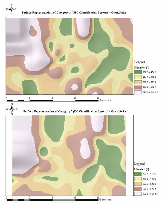
This category representation in both systems is toward an emphasis on similarity coupled with consistency in the two schemes. There is an increased uniformity in this category distribution as apparent both in the elevation range values and the map pattern. The elevation ranges for this category is the most similar compared to earlier categories as this range almost converge towards the same range values. In addition, there is almost equal borehole representation in both schemes emphases competing representation in the two schemes. However, there are considerable global and spatial shifts. GSC system has greater spatial coverage for this category indicating distributed well-logs for this material in the GSC scheme.


