Methodology
The methodology for this project seemed deceptively simple: use an aerial photograph to create landuse friction values, find and digitize the data points, and use the two to create a cost distance analysis. Indeed, much of the work involved in this project falls off the cartographic map of the methodology. The process for data collection is mentioned elsewhere.
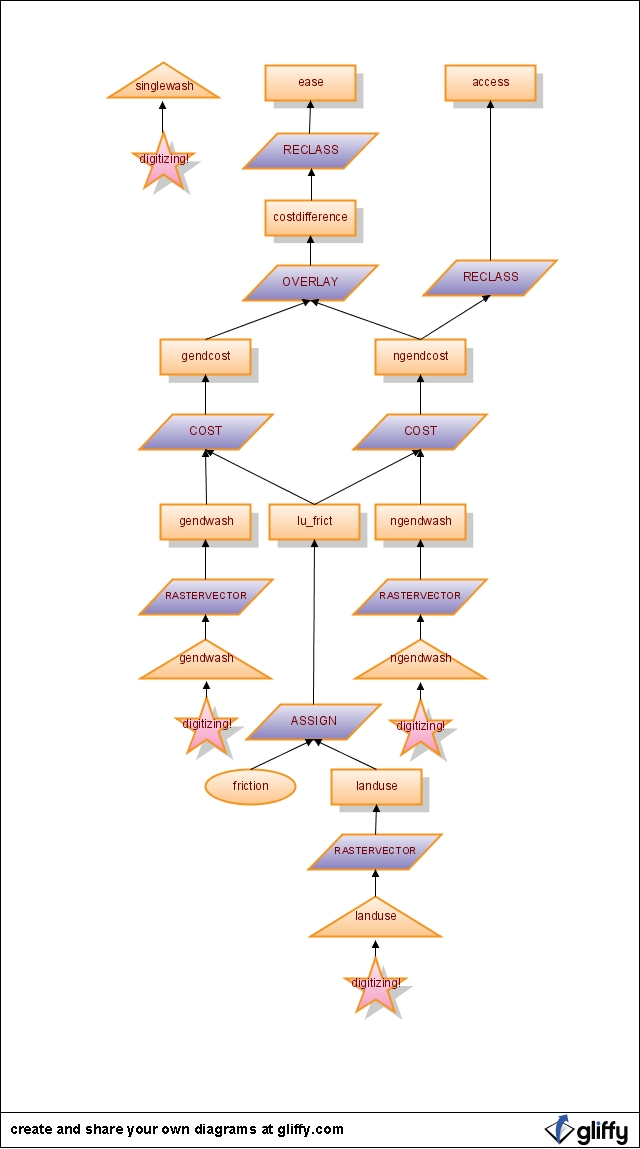
Conceptual methodology, click to enlarge
Nifty flowchart created through gliffy.com
I did more work, and ran into more problems, than this methodology would indicate. First, the aerial photograph needed to be projected and digitized in ArcMap, and then the shapefile imported into Idrisi. Similarly, data collection for the points involved hours travelling the campus looking for bathrooms before digitizing could begin. During the spatial analysis, additional modules were used to reduce the scale and the resolution.
Copyright © Lindsay Dignall, 2008