Spatial Analysis
The primary analysis needed for this project was a cost distance analysis; that is, how difficult it would be for someone to find a washroom. The first step was to determine the difficulty of traversing the various landuse types.
Friction Value of Landuse Type| Landuse Category | Friction Value | Reasoning |
|---|---|---|
| Unwalkable | 100 | An unwalkable area is outside of the study area or otherwise inaccessible to pedestrians without great personal effort. |
| Building | 60 | Buildings are good for pedestrians as they are indoors and usually contain bathrooms. However, sometimes they are labyrinthine and contain multiple floors, or are inaccessible to the general public. |
| Walking Area | 10 | A walking area has been designed for pedestrians, with safety and destination in mind. |
| High Traffic Pathway | 1 | High foot traffic pathways are proven to be useful to pedestrians, and it can be assumed a pedestrian will use this area over all others to get to their destination. |
| Courtyard | 25 | Courtyards provide easy access to adjacent buildings, but are occassionally inaccessible as well. They include a mix of obstacles, including roads, grass, lines of trees, water structures, and stairs. However, they usually consist of one level and designed for pedestrian traffic. |
| Road | 50 | Roads are dangerous to pedestrians and prioritize vehicle traffic over foot traffic. |
| Parking Lot | 40 | Parking lots are dangerous to pedestrians and generally located far away from amenities such as washrooms. |
Following that, I applied the friction costs to the various landuse areas with ASSIGN.
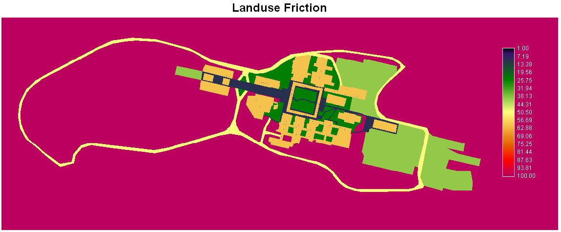
Friction map of landuse, click to enlarge
.The next step was to use the COST module to do cost distance analysis from each set of points: gendered and gender neutral washrooms. This is a reversal of the general use of cost distance analysis; generally, you'd start at one location and determine how difficult it is to get to another location. We are instead doing the cost distance from the destination point.
I encountered difficulties at this point, presumably due to the high resolution of the raster files. I made extensive use of the WINDOW and CONTRACT modules to reduce both the resolution and the scale. This made all raster files much easier to work with; however, COST still took over half an hour to run on each set of points!
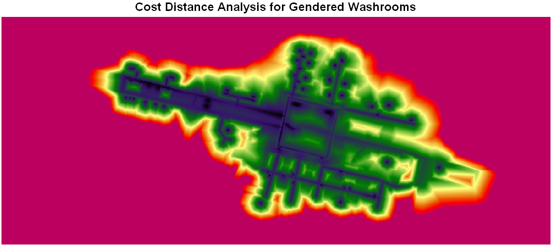
COST results for gendered washrooms, click to enlarge
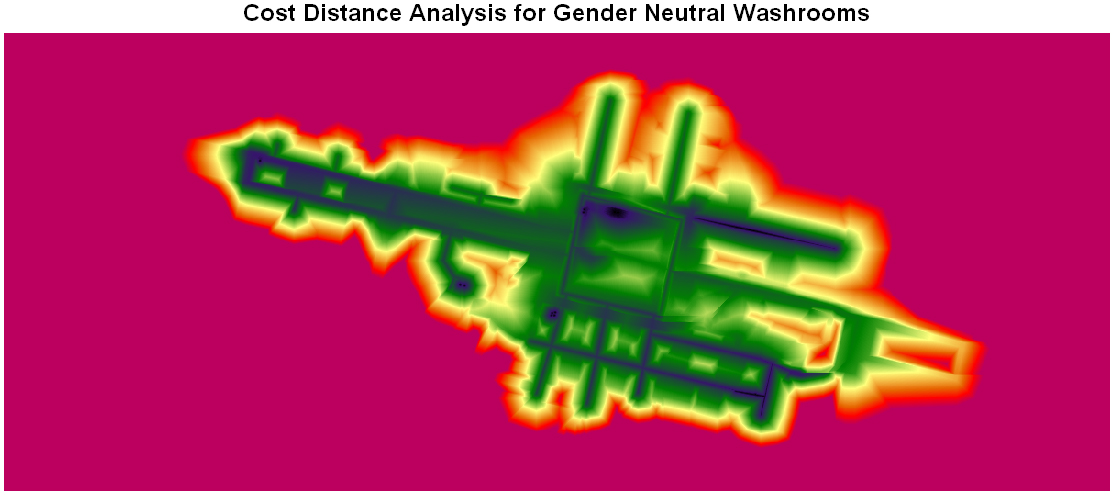
COST results for gender neutral washrooms, click to enlarge
Both results have been windowed to cut away the forested areas surrounding the campus. Also, the display threshold has been reduced to 35000 units to accentuate the differences between the results.
The difference between the two results was subtracted using OVERLAY to give the relative ease of finding a gender neutral or gendered washroom. This output was used to create one of the final map outputs on the Discussion and Results page.
Copyright © Lindsay Dignall, 2008