|
Spatial Analysis: |
The project
will apply multi-criteria analysis (MCA) to evaluate all factors
and constraints in order to determine the suitability in the
study area. In IDRISI, there are two ways to operate MCA. Users
can use the Decision Wizard or use Micro Modeler to construct a
cartographic model of MCA. This project will use the later
method.
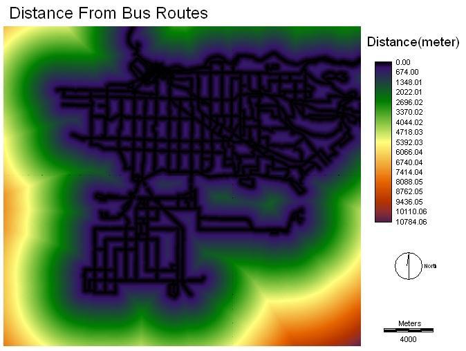
FactorsFrom the raster data files obtained from data preparation, the module of "DISTANCE" is applied to calculate the distances from 1)SkyTrain station location, 2)library location, 3)community centre location, and 4)bus route.
Then, the "FUZZY" module is applied to scale and standardize the values of each factor in units between 0-255. The 8-bit standardized data files of each factor are fit to compare and combine in the MCA. In "FUZZY" operation, the membership function shape and type and the control points for each factor need to be specified. The following table describes how factors are standardized in this module. Click on the factors to see the results:
|
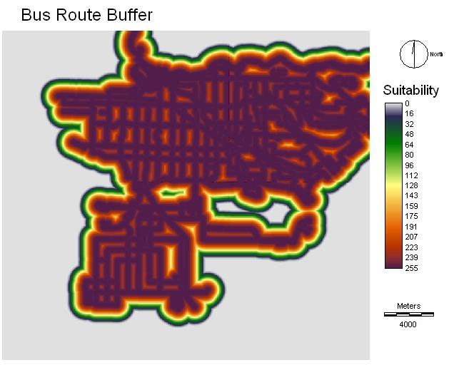
The map below shows the result of “FUZZY” module applied to the distance image of bus route.
For the land use factor, the "RECLASS" module is used to scale the value from 0 to 255 and create a "FUZZY" image. Excluding all unsuitable land use's areas, Agricultural land is assigned 100, industrial area 150, commercial area 200, residential area 225, open and undeveloped area 255.
Constraint
The “RECLSS” module is used to create a Boolean map indicating the constrained suitable area in the MCA. The land use file is used. The procedure is to assign 0 to area of 1) recreation and protected natural areas, 2) lakes and water bodies, 3) Institutional, and 4) transportation, communication and utilities; and 1 is assigned to the suitable land uses that mentioned above.
Weight Linear Combination
After all "FUZZY" images of the eight factors are obtained, they can be input into the “MCE” module of Micro modeler. However, since each factor has different importance in this analysis, the decision making process known as Analytical Hierarchy Process (AHP) is suitable. In this decision process, the weight index for each factor is calculated by using the “WEIGHT” function in IDRISI. In the "WEIGHT" operation, pairwise comparison between two factors is used to evaluate the importance of each input factor. The following table shows the pairwise comparison matrix (the rating of the row factor relative to the column factor) and the weight computed by the "WEIGHT" module. The rating is good with consistency ratio of 0.06. Click on the links to see the explanation of rating between factors.
|
|
Skytrain |
Bus route |
library |
Community centre |
Pop. (10-59) |
Pop.(education) |
Pop.(immigrant) |
Land use |
Weight |
|
Skytrain |
1 |
1/3 |
3 |
3 |
1/3 |
1/3 |
1/3 |
1 |
0.0687 |
|
Bus route |
1 |
3 |
5 |
1/3 |
1/3 |
1/3 |
1 |
0.1177 | |
|
library |
1 |
1 |
1/5 |
1/5 |
1/3 |
1/3 |
0.0355 | ||
|
Community centre |
1 |
1/7 |
1/7 |
1/5 |
1/5 |
0.0266 | |||
|
Pop. (10-59) |
1 |
1 |
3 |
3 |
0.2487 | ||||
|
Pop.(education) |
1 |
3 |
5 |
0.1400 | |||||
|
Pop.(immigrant) |
1 |
1 |
0.2702 | ||||||
|
Land use |
1 |
0.0925 |
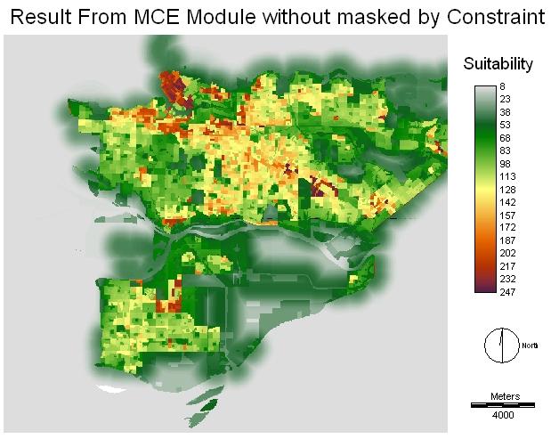
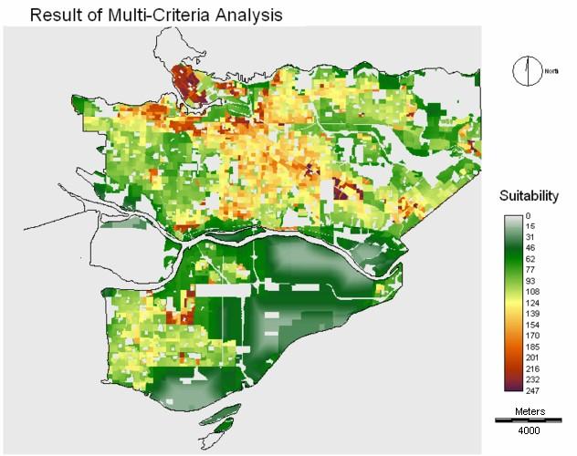
After the weight factors for all "FUZZY" layers are determined, the "MCE" module is used to combine and evaluate the suitability of locations. After the MCE operation, the constraint layer, which was prepared before, is multiplied to the MCE result image. The multiplied image is the result which is equivalent to that done by the Decision Wizard.