Priority Counties for Rainwater Harvesting on the Ogallala Aquifer, Texas
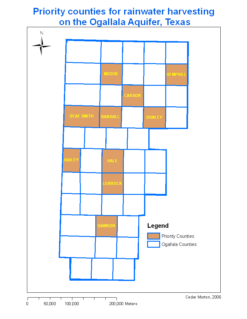
The boolean map from the MCE results was exported to ArcMap where it could be displayed with the Ogallala Counties map. This revealed that the ten counties that should be prioritized for funding for a rainwater harvesting program are: Bailey, Carson, Dawson, Deaf Smith, Donley, Hale, Hemhill, Lubbock, Moore and Randall.
This spatial analysis reveals that GIS can be very useful in generating new knowlege based on collected data. In this case, if any one of the factors were used alone to determine the most suitable counties for funding, the results would be very different. Simply considering difference between the MCE results and the ten counties that were isolated by the well density analysis shows that an MCE can produce more robust information to help decsion makers make the best possible choices.
| Home | Introduction | Data aquisition | Methodology | Spatial analysis | Discussion/results | Problems |
|---|
Discussion/results |
|---|