The Ogallala Aquifer is located beneath the Great Plains of the United States and is one of the world's largest aquifers. The underground water source spans eight states, including the northernmost part of Texas. Forty-six Texan counties rely heavily on the aquifer for agricultural and domestic water supply and it provides more water to Texans than any other aquifer in the state. Since the 1940s groundwater withdrawals from the Ogallala exceeded the rate of recharge from precipitation and this resulted in a declining water table. Because of the importance of the aquifer to agriculture on the Great Plains, many researchers became concerned about the rate of its decline and US Congress authorized a $US 6 million study in 1976 to determine development alternatives that might help preserve the Ogallala. Although many other studies have taken place since 1976, and although a bureaucracy has been established to address Ogallala conservation and many water conservation efforts have been attempted, the aquifer continues to decline.
The main organization repsonsible for water conservation in Texas is the Texas Water Development Board (TWDB). This government body was created in 1957 and its primary functions are the provision of funding, planning expertise, data collection and distribution and administration of water rights. According to TWDB, Ogallala groundwater levels have dropped in excess of 91.44 metres since the 1940s and projections indicate a 32% decrease in groundwater supply for all of Texas between 2010 and 2060 due to increasing population and agricultural demand..
One conservation measure that the TWDB promotes is rainwater harvesting. Simple rainwater harvest systems can be installed in homes and more complex systems can be used by large companies for commercial use. The state of Texas provides tax incentives for water users who utilize rainwater harvesting systems. As the Ogallala continues to disappear, it is possible that the state will implement more a more agressive water conservation agenda by funding rainwater harvesting programs in counties situated on the aquifer. Because financial resources are limited, the TWDB will be required to provide an assessment of which counties should be priority areas for funding.
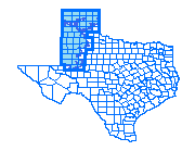
This GIS spatial analysis uses well, precipitation and surface water data along with information about groundwater conservation districts, priority groundwater conservation areas, and proposed interbasin transfers to determine which ten of the forty-seven counties situated on the Ogallala should receive priority funding for rainwater harvesting programs.
| Home | Introduction | Data aquisition | Methodology | Spatial analysis | Discussion/results | Problems |
|---|
Introduction |
|---|