Spatial Analysis
The Spatial Analysis of the various layers I have
created produces some very intriguing results. I will get to those,
but only after showing the steps used to reach that final destination,
the finish line if you will. Displayed will be the determining layer
and the boolean layer associated with it. Shall I wave the green
flag?
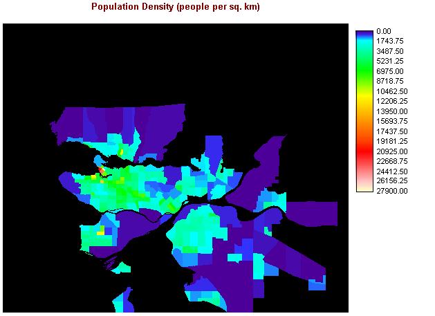
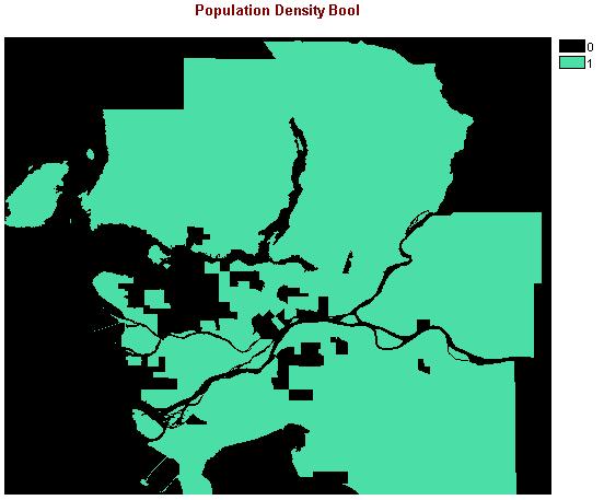
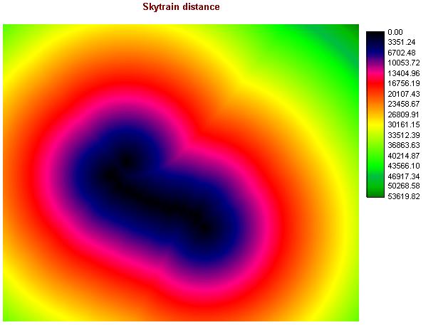
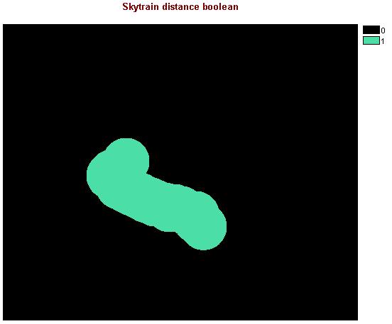
After incorporating just the Skytrain Distance and Population Density images, I ended up with this map:
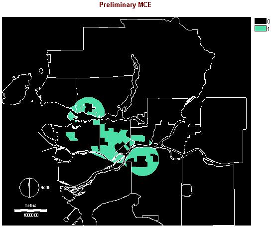
The final product, as a result of a full Multi-Criteria Evaluation, using boolean intersection produces this map:
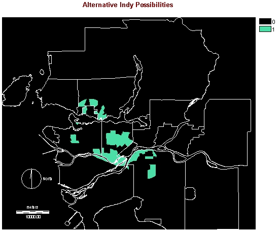
As you can see there are numerours clumps of land that fit the bill, so to speak. Of these not all could actually be used, as the smallest of them would not be large enough to contain the track and its facilities. Facilities include the pit paddock, grandstands and concession areas. These are temporary facilities that are only constructed for the race weekend. The entire pit paddock area is set up by CART and its teams. This mobile unit makes its way to each race of the season.
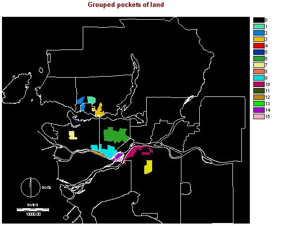
As some are better than others for the task, have arranged the land areas by their size and perimiters, first using the GROUP function, followed by AREA and PERIM operators on that grouped image.
Grouped image:
Area image: Perimeter image:
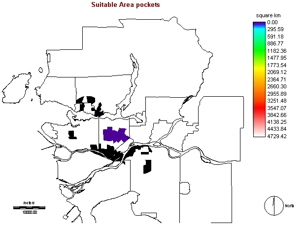
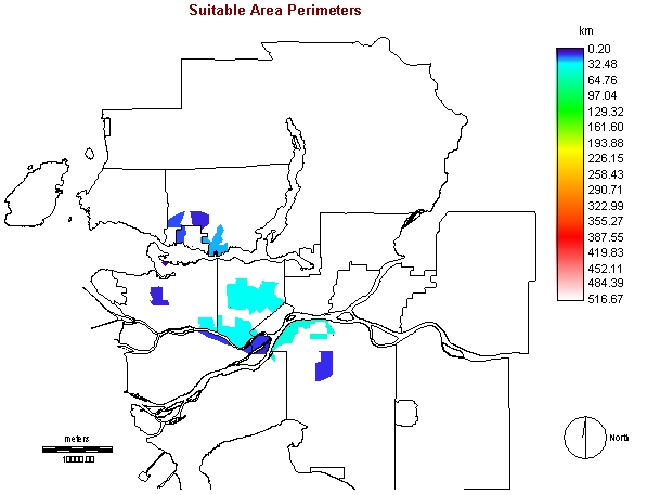
The above maps are efficient in showing which pockets of land stand out from the rest. The largest pocket, located in central burnaby is large in area and perimiter. This location encompasses Metrotown and adjacent land. Of all of the pockets above, I would say that this location has many positive aspects. It is centrally located in the Lower Mainland, making it accessible by all. The Skytrain runs through this pocket, making it even more attractive. From a racing aspect, the wide multi lane roads (Kinsway, Willingdon, Grange, Central, Nelson) make for a good racing surface. The parking lots of Metrotown could be converted into spectator and support areas. Why thing pocket is better suited to street racing is because the land is relatively flat. The pocket of land in Surrey might also have some of the same properties as this one. Flat ground is needed because these cars are essentially airplanes that do not take off. There wings on the front, rear, and undercarriage of the car to keep it planted firmly on its racing slicks. Sloped ground could actually cause these open wheel racers to become airborne.
While the Metrotown area tends to be crowded with both people and vehicular traffic on a regular basis, I think the positive aspects of a global event such as CART racing overwhelm those of negative influence.