Many steps were taken in order to come up with the
final outcome of a new Skytrain route
and stations from Maple Ridge to Lougheed Mall. In order to create
the least cost pathway
for the track, the first thing that had to be done was to find the
locations of all of the stations.
The first thing that I did for this analysis was
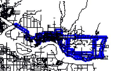
to digitize all of the bus routes for the Maple
Ridge to Port Moody area (seen on the Data
Collection Page ). I then used these bus routes
to create an arbitrary buffer around them. This buffer, and many
other buffers in this project
use the assumption that 500 meters is about as far as the average person
would walk to catch
a bus or Skytrain. Of course, many people would be willing to
walk much farther, but without
a study into the actual distance, it is impossible to be sure exactly
how far.
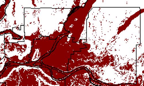
Maple Ridge Bus Buffer
Coquitlam Bus Buffer
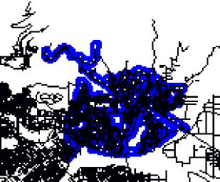
I then used these two buffer areas and other factors
in order to create an MCE showing
possible station sites. These station sites were found by using three
other criteria. The first
was on locations that were open undeveloped ,the second was that they
were within a certain
distance of residential areas, and third, the sites were to be on relatively
flat land, no steeper
than 5 degrees.
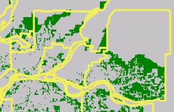
The first of these three criteria, being on open
undeveloped sites is very important. Sites that
fit into this classification will likely be cheaper to use. There
will be no excavation costs. They
will also be able avoid some conflicts from protesters that would surely
occur if the land was
occupied in some way. The open undeveloped sites do not include
park land, agricultural, or
any other type of land that may be cause for concern. They are
just land that is zoned for a
specific purpose, but currently unoccupied.
Open Undeveloped Lands (Green)
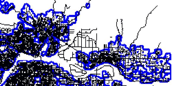
The second criteria used was the distance from residential
areas. As was stated above, the
arbitrary distance of 500 meters was used. An arbitrary distance
of 100 meters was also used
in this part of the analysis. This distance was a buffer around
the residential areas that the stations
could not be put within. It is very likely that there will be
many protests if the station was placed on
undeveloped land right next to residential. The buffer of 100
meters was used to possibly prevent
some of these protest. This means that there will be a 400 meter
area around the residential area
where the stations can be placed. Not beyond 500 meters but not
within 100 meters.
The above criteria was created by overlaying the
two buffer zones in an XOR manner. Only
the 400 meter area was left because the 100 meter area was taken away
because this is the only
area where the two buffer zones overlap.
400 Meter Buffer Zone
Next came the 5 degree slope criterion. A boolean
slope of 5 degrees was chosen because it
makes sense to build on flat land. Building on highly sloped
land will just make this project more
expensive.
The slope was created by using the SURFACE operation
on the DEM. The new slope was then
RECLASS to find the appropriate 5 degree slope.
5 Degree Slope (Red < 5 degrees)
The 400 meter buffer, the 5 degree slope, the open
undeveloped, the coquitlam bus buffer, and the
Maple Ridge bus buffer were all used in an MCE that created total station
sites. These are the areas
that are the best sites for the Skytrain Station.
All of the sites were then grouped and the area
was found. RECLASS was then used on all of the
grouped areas to eliminate all sites less than 2500 square meters.
This would give plenty of space to
build the new Skytrain station. This new layer of reclassed area
is called "Bigones".
Bigones
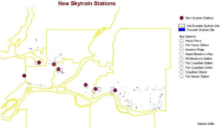
I then used the digitized bus stations as well as
my own knowledge to chose where the new Skytrain
stations should go. I chose the plots of land from Bigones that
were closest to the bus stations as long
as two stations were not too close. If two stations are quite
close, like that in Port Coquitlam, I chose
the station site from "Bigones" that would be most useful to both.
This is the station site nearest to both
bus stations.
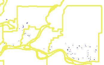
New Skytrain Station Sites
Back to Project Page
Back to INDEX