|
|
RESEARCH |
|
Student research opportunities
MSc/PhD opportunities in Paleoglaciology, paleohydrology and Quaternary environmental change
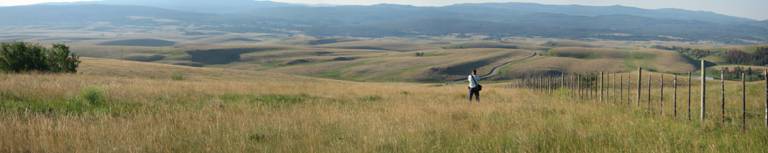
Specific field projects 1) The geomorphic and sedimentary relationships of eskers in BC and Alberta These field projects (one in Alberta, the other in BC) would use sedimentology, shallow geophysics, DEMs and GIS to describe esker characteristics and infer genesis and meltwater channel type. Such knowledge is necessary if eskers are to be used robustly as verification for numerical ice sheet models, and in geomorphic inversion-based paleo-ice sheet reconstructions on Earth and Mars. 2) Last CIS ice-dammed proglacial lakes: water storage and release These projects (likely two in separate basins) would use geomorphic and sedimentologic observations (possibly also shallow geophysics and optical dating) in a GIS in order to reconstruct lake paleogeography, determine the volume of water stored, and explore and model (paleohydrology, paleohydraulics) the nature of lake drainage. Such data will facilitate estimates of landscape and sea level change associated with drainage events. 3) Last-glacial subglacial lakes within the footprints of North American ice sheets: testing model predictions These projects (one or two in BC, possibly AB) will explore the sedimentary, stratigraphic and geomorphic record in basins with a modeled high potential for paleo-subglacial lake formation and thus refine the diagnostic criteria for the identification of paleo-subglacial lakes. Knowledge of the geologic record of paleo-subglacial lakes will assist glaciologists in their early exploration of present-day subglacial lakes. Knowledge of the associations between paleo-subglacial lakes and their surrounding glacial geomorphology will allow the effect of subglacial lakes on meltwater drainage, ice flow and ice streams to be assessed.
Specific GIS and RS projects 4) The morphology and landform associations of eskers in Keewatin. Very little is known about the detailed morphology and landform associations of northern eskers. Whereas most Laurentide eskers formed in ice tunnels that terminated in lakes, those in Keewatin may have formed in ice tunnels that terminated on land, and hence their morphology and landform associations should differ. This GIS/RS project would add important new data to the question of esker genesis at a time when research suggests an important climate control on esker distribution in the Keewatin region. 5) Comparison of esker morphology on Earth and Mars. This GIS/RS project would involve mapping morphometric variables of eskers and comparing datasets. It would assist Marian scientists in their ability to identify Marian eskers and hence infer paleoclimate
Some other possible field projects could include: 6) Character and environment of the Nicomen gravel and/or other thick gravel packages within the Thompson River valley, BC. This field project will enhance our knowledge of the character of ice sheet advance and/or retreat. Thick sheet-like gravel beds within otherwise braided gravel units in valley-fill sequences suggest periodic flooding during ice advance/retreat which in turn favours surging behavior in the ice sheet. To date the relative age of these sequences has been asserted from loose stratigraphic position; optical dating would provide absolute ages for the sediments. No detailed sedimentologic descriptions of these gravels have yet been made. 7) 3D architecture and composition of subglacial bedforms in the Puget Lowland and/or on the BC interior plateau. This field project will provide new datasets to address the question of subglacial bedform genesis under the Cordilleran Ice Sheet (CIS), and under ice sheets more generally. It is timely in that streamlined bedforms have been recently imaged beneath an Antarctic ice stream, and are often used as an indicator of paleo-ice stream locations, yet their genesis remains allusive. We are curently quantifying the morphometry of Puget Lowland subglacial bedforms, and assessing controls on bedform morphometry. This project would build on that work and produce detailed 3D models of the sedimentary architecture of select bedforms in order to elucidate their genesis. An alternative or contrasting location for this project is the BC interior plateau.
Qualifications Applicants should be highly-motivated, with a solid background in Quaternary geology and/or geomorphology, and/or paleoglaciology/paleohydrology/paleohydraulics and of excellent academic standing. You should also have experience in, or a desire to learn, sedimentology, topographic surveying, digital terrain analysis, aerial photograph interpretation, GIS, RS, shallow geophysical techniques, and/or geochronology depending on the project. Physical fitness, and prior backcountry and/or field work experience will be considered an asset in field projects.
Funding and applications Interested students are encouraged to contact me as soon as possible via email (tabrenna@sfu.ca) and to send a CV/resume, an unofficial copy of university transcripts, and a brief statement of scientific interests. For official application instructions please consult the Department of Geography Graduate Program website. The deadline for applications from students wishing to enter the graduate program are January 22nd (September entry for PhD and MSc students; consideration for SFU scholarships and awards) and September 15th (January entry under excetional circumstances for PhD students only). Funding for masters and doctoral students in the Paleoglaciology Lab is available through a combination of scholarships, research assistantships, grants and teaching assistantships. Externally funded students are encouraged to apply.
Post-doctoral opportunities I welcome applications from post-doctoral researchers with external funding who wish to pursue research that falls within the thematic areas of my research program: paleo-ice sheet hydrology, paleo-ice sheet dynamics, and paleoenvironmental change. Select external funding sources are listed on my links page. UK applicants are encouraged to obtain funding through the Leverhulme Trust.
Undergraduate student opportunities I welcome applications from undergraduate students interested in taking up research assistantships. I normally have field assistant positions open for the summer, and work study (labratory/GIS) positions open year round. The annual deadline for applications for funding from the Natural Sciences and Engineering Research Council - Undergraduate Student Research Awards (NSERC-USRA) program, the program I typically use to fund summer field assistants, is mid-January. Information about the work study program is available here.
For further information contact: Tracy A. Brennand office: RCB 7137 |