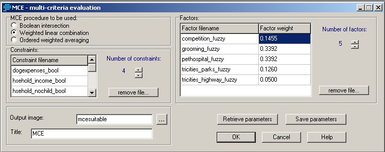
To get a suitable area to open a new dog daycare, I chose to use the Multi-Criteria Evaluation (MCE) with Weighted Linear Combination. To do the MCE analysis, I have to convert the distance images into bytes (0-255) by using FUZZY. And I use WEIGHT to do a pairwise matrix comparison for the MCE. The final result of the analysis will be produced after combining the constraint images with the pairwise comparison file.
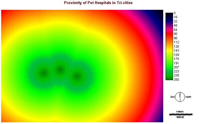
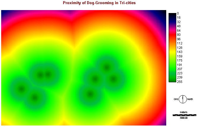
I. FUZZY of Proximity of Conglomeration (Pet Hospitals & Dog-Grooming)
Both FUZZY, phospfuzzy & groomfuzzy, are using monotonically decreasing of Linear function, as more suitable to open dog daycare nearby the conglomeration. The values of control points of c and d are shown on the cartographic model.
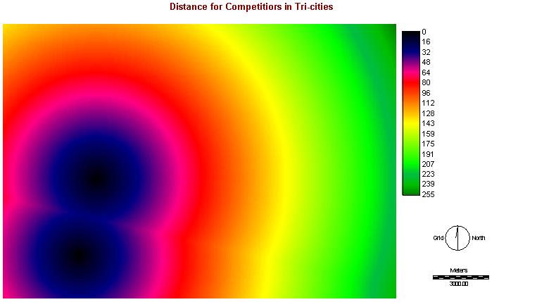
II. Distance from Competitions:
Competfuzzy is also using the Linear function, but with monotonically increasing, as more suitable while further away from competitors. The values of control points of a and b are shown on the cartographic model.
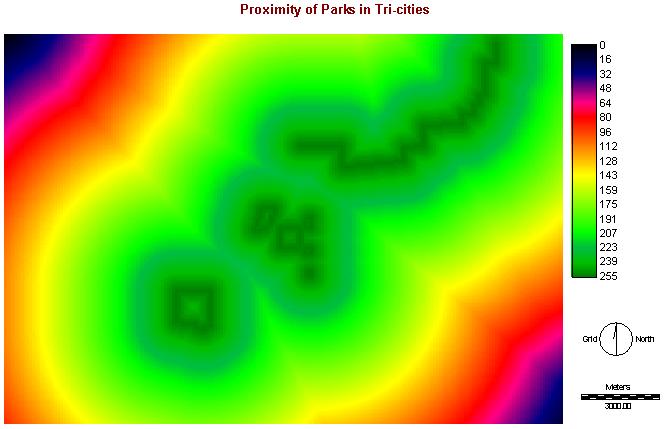
III. Proximity of Parks:
Parksfuzzy is using the Linear function with monotonically decreasing, as more suitable to be nearby the parks, as mentioned in methodology before. The values of control points of c and d are shown on the cartographic model.
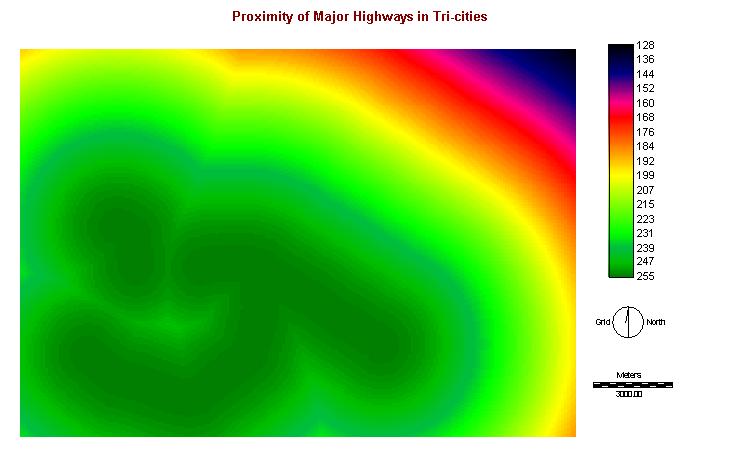
IV. Proximity of Highways:
Highwaysfuzzy is using J-shape function with monotonically decreasing, as even further away from the highways, the suitability would not be absolute zero. The values of control points of c and d are shown on the cartographic model.
With using WEIGHT, the eigenvector of weights and consistency ratio are shown in the following:
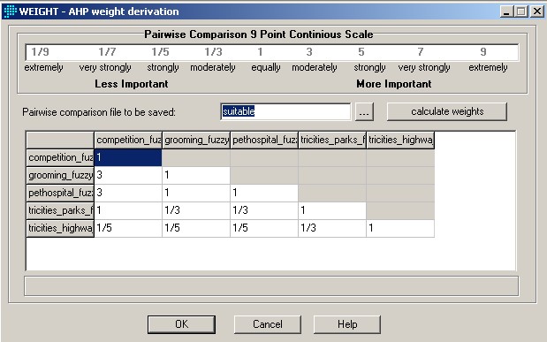
Consistency Ratio: 0.03
competition_fuzzy: 0.1455
grooming_fuzzy: 0.3392
pethospital_fuzzy: 0.3392
tricities_parks_fuzzy: 0.1260
tricities_highway_fuzzy: 0.0500
I considered the dog-grooming, pet hospitals and parks are more important than competitions and highways. Therefore, this result fulfilled my requirement. And with combining the constraint images as following:
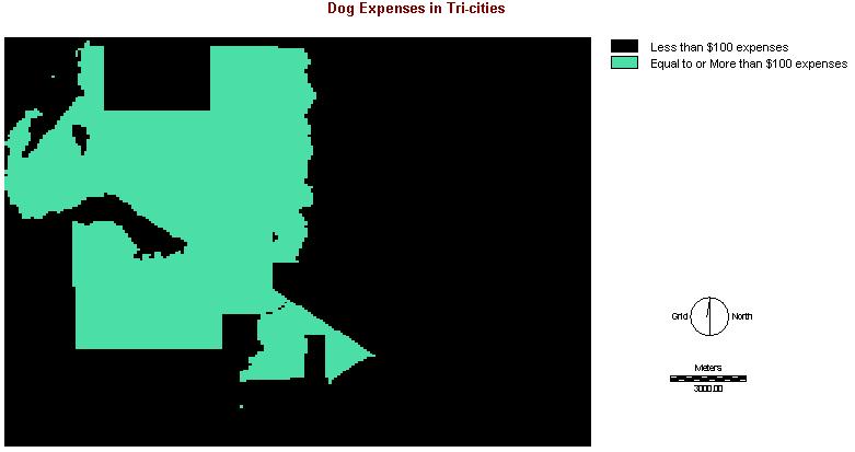
I. Dog Expenses (expensecon) Click here for Cartographic Model
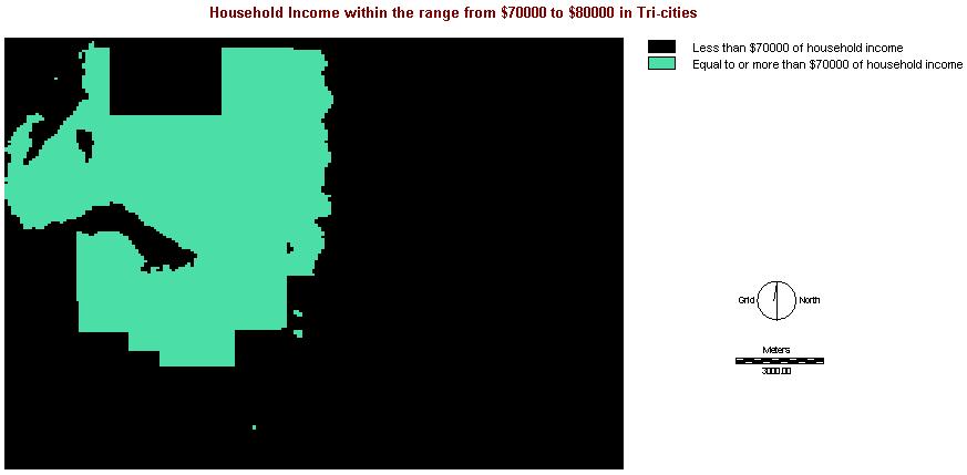
II. Household Income (incomecon) Click here for Cartographic Model
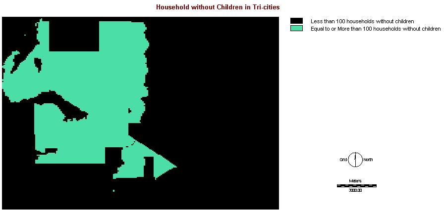
III. Household with No Children (nochildcon) Click here for Cartographic Model
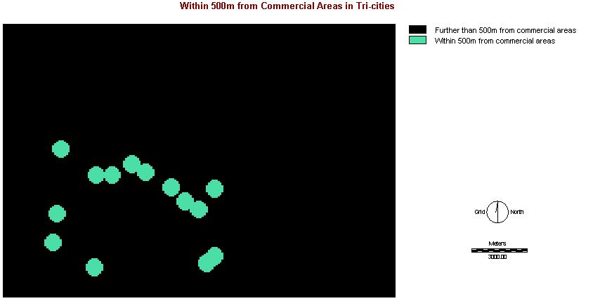
IV. Commercial Areas (commercialcon) Click here for Cartographic Model
RESULT:
By combining the constraint images with the pairwise comparison file in MCE, the result is:
Click here for Cartographic Model of MCE
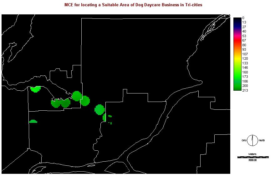
Most suitable areas are located around Port Moody.