This project is designed to analyze which areas would be suitable and fulfill the criteria to open a new dog daycare business in Tri-cities, which include Port Moody, Coquitlam, and Port Coquitlam.
The criteria are classified as factors and constraints in the following:
FACTORS:
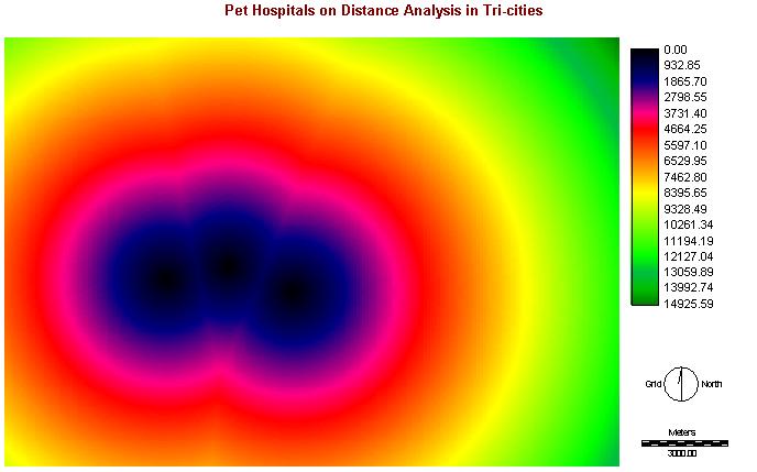
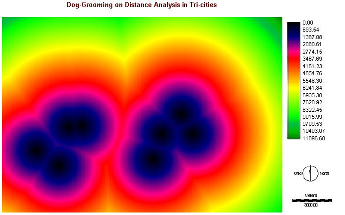
I. Proximity of Conglomeration (Pet Hospitals & Dog-Grooming)
If the new dog daycare is situated nearby these pet hospitals and dog-grooming, this is one of the factors to attract more dog owners.
Methods:
Both are using the postal codes and inputting into the dbf files in Access
By joining the tables in Arcview with the file of LDU.shp and convert into new shapefiles
Importing the new shapefiles into IDRISI and changing the files into raster format, "pethospr.rst" & "groomingr.rst"
With using ASSIGN, to reclassify the data
Before doing FUZZY, DISTANCE is needed for calculating the distance from locations. FUZZY is used for rescaling to a range of suitability where the greatest cost distance has the lowest suitability score (0) and the least cost distance has the highest suitability score (255)
Click to See Cartographic Models of phospfuzzy & groomfuzzy
Images of pethospdist & groomingdist:
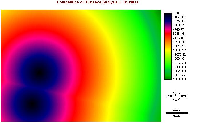
II. Distance from Competitions:
Competitions is an important factor that can influence the profit of the new dog daycare business.
Methods:
Same as the proximity of conglomeration, collecting the postal codes of competitors and converting them into dbf file in ACCESS
Joining the tables in Arcview with the file of LDU.shp and convert into new shapefiles
Importing the new shapefiles into IDRISI and changing the files into raster format, "competr.rst"
Using ASSIGN to reclassify the data
Before doing FUZZY, DISTANCE is needed for calculating the distance from locations. FUZZY is used for rescaling to a range of suitability where the greatest cost distance has the lowest suitability score (0) and the least cost distance has the highest suitability score (255)
Click to See Cartographic Models of competfuzzy
Images of competdist:
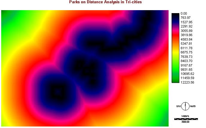
III. Proximity of Parks:
As opening a dog daycare business, we are responsible to take the dogs to have dog walk. Therefore, parks are also important to be considered in this project.
Methods:
Data of "parks.shp" from S:/drive, as these data are for GVRD, I have to clip the Tri-cities areas only. I used the function of "Selected by Theme" in Arcview to select the parks that are in Tri-cities only and saved as new shapefile
And project the new shapefile into the projection of UTM 10n
Importing the new shapefiles into IDRISI and changing the files into raster format, "parksr.rst"
Using ASSIGN to reclassify the data
Before doing FUZZY, DISTANCE is needed for calculating the distance from locations. FUZZY is used for rescaling to a range of suitability where the greatest cost distance has the lowest suitability score (0) and the least cost distance has the highest suitability score (255)
Click to See Cartographic Models of parksfuzzy
Images of parksdist:
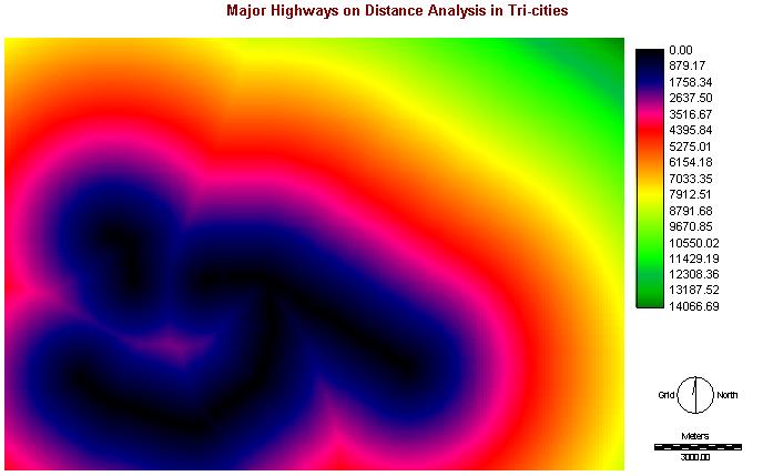
IV. Proximity of Highways:
With opening any businesses, transportation must be one of the important factors. We assumed most of the dog owners drive, so proximity of highways should be considered.
Methods:
Same as the proximity of highways, data of "juststreets.shp" from S:/drive, as these data are for GVRD, I have to clip the Tri-cities areas only. I used the function of "Selected by Theme" in Arcview to select the major highways, Lougheed Highway and Barnet Highway, and saved as new shapefile
And project the new shapefile, "highways.shp", into the projection of UTM 10n
Importing the new shapefiles into IDRISI and changing the files into raster format, "highwayr.rst"
Using ASSIGN to reclassify the data
Before doing FUZZY, DISTANCE is needed for calculating the distance from locations. FUZZY is used for rescaling to a range of suitability where the greatest cost distance has the lowest suitability score (0) and the least cost distance has the highest suitability score (255)
Click to See Cartographic Models of highwaysfuzzy
Images of highwaysdist:
CONSTRAINTS:
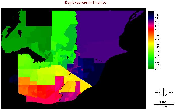
I. Dog Expenses
We should know about how much the dog owners are willing to spend on their dogs in our study area. The areas with higher expenses on dogs' appliances would have higher potential to run a good dog daycare business.
Methods:
Copy the data that I needed from Excel and input into dbf file in ACCESS
Joining the table with "demographics.shp" and converting into new shapefile
And project the new shapefile, "dogexpense.shp", into the projection of UTM 10n
Importing the new shapefiles into IDRISI, "expensev.vct" and changing the files into raster format, "expenser.rst"
Using RECLASS to reclassify the data
Click to See Cartographic Models of expensecon
Images of expenser:
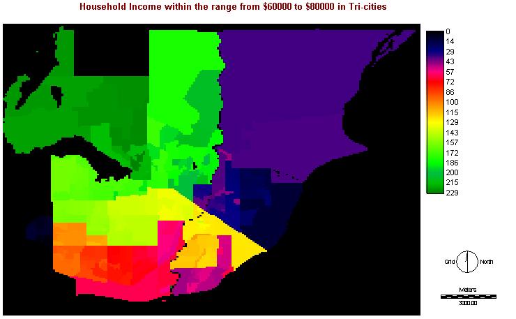
II. Household Income
As my target customers are having income within $70,000-$80,000, the people in these income range should be able to afford better living, and also able to taking dogs. They have to work on weekdays, so no one can take care their dogs.
Methods:
Copy the data that I needed from Excel and input into dbf file in ACCESS
Joining the table with "demographics.shp" and converting into new shapefile
And project the new shapefile, "income.shp", into the projection of UTM 10n
Importing the new shapefiles into IDRISI, "incomev.vct" and changing the files into raster format, "incomer.rst"
Using RECLASS to reclassify the data
Click to See Cartographic Models of incomecon
Images of incomer:
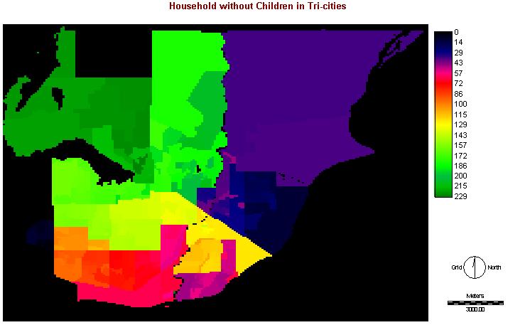
III. Household with no children
As my target customers are needed to work and do not have time to take care the dogs, they even cannot have time to take care children. Therefore, I will also take the household without children as one of the constraints.
Methods:
Copy the data that I needed from Excel and input into dbf file in ACCESS
Joining the table with "demographics.shp" and converting into new shapefile
And project the new shapefile, "nochild.shp", into the projection of UTM 10n
Importing the new shapefiles into IDRISI, "nochildv.vct" and changing the files into raster format, "nochildr.rst"
Using RECLASS to reclassify the data
Click to See Cartographic Models of nochildcon
Images of nochildr:
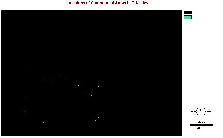
IV. Commercial Areas
A commercial area must be considered for opening a dog daycare business, because it may not open nearby the residential or industrial areas, etc. Therefore, the landuse is an important constraint in the project. (But I have a problem on analyzing the data, I will discuss it on methodological & operating problems.)
Methods:
As not able to use the GVRD landuse to analyze for the Tri-cities areas, I based on the file of "landuse.rst" to digitize the commercial areas in Tri-cities in IDRISI
After digitizing, converting those vector points to raster format, "commercial_r.rst"
Using RECLASS to reclassify the data
Using BUFFER with 500m of buffer zone, setting target features and areas within the buffer zone are 1 and areas outside the buffer zone is 0
Click to See Cartographic Models of commercialcon
Images of commercialr: