Part One:
Essential Criteria
This is a spatial analysis of the best new location
for the placement of a provincial campsite. The area under consideration
is Vancouver Island, British Columbia. The following illustrations are
graphic displays of operations and procedures undertaken in Idrisi32 to
derive a potential location for a new provincial campsite. The illustrations
are accompanied by descriptions of the analyses for each step. For a complete
summary of operations and procedures, please refer to my Cartographic
Model.
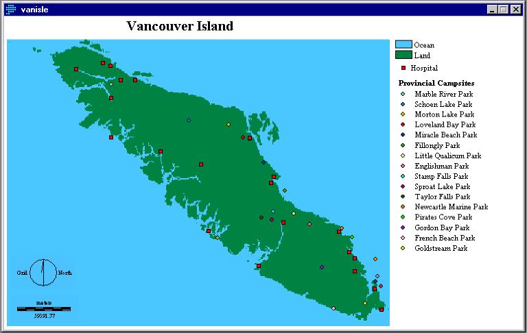
To determine where to situate a new campsite,
the locations of existing campsites and hospitals were digitized. I rasterized
these vector points and used DISTANCE and BUFFER operations to find the
places that were located at a distance greater that 10 km of an existing
campsite and at a distance within 15 km of hospitals.
Fig. 1
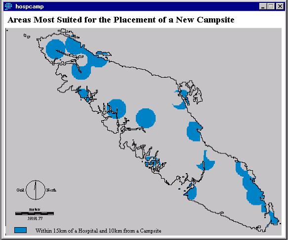
I then used the OVERLAY (multiply) function to create a boolean image of the two criteria to create the following image (HOSPCAMP):
Fig. 2
One of the most popular recreation activities associated with camping on Vancouver Island is fishing. To attract campers, the new site should be in close proximity to fishing lakes, rivers, and streams. The layer containing fishing rivers was digitized, all layers were rasterized using either the POINTRAS or LINERAS operations, and then the layers were reclassed to possess a value of one (necessary for the following procedures). I used the Image Calculator to overlay fishing lakes and fishing streams in a Boolean OR operation. The fishing river layer was then overlain (also using the Image Calculator and the OR function) on the resulting image to create the following image of fishing areas on Vancouver Island.
Fig. 3
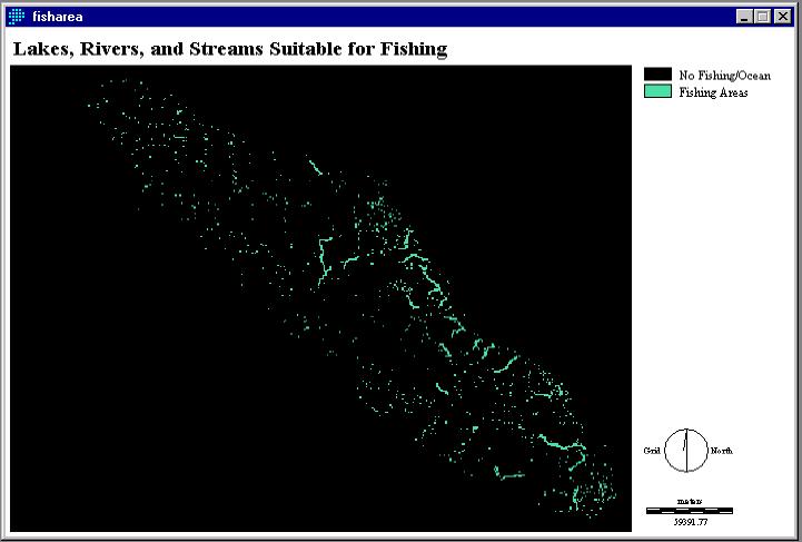
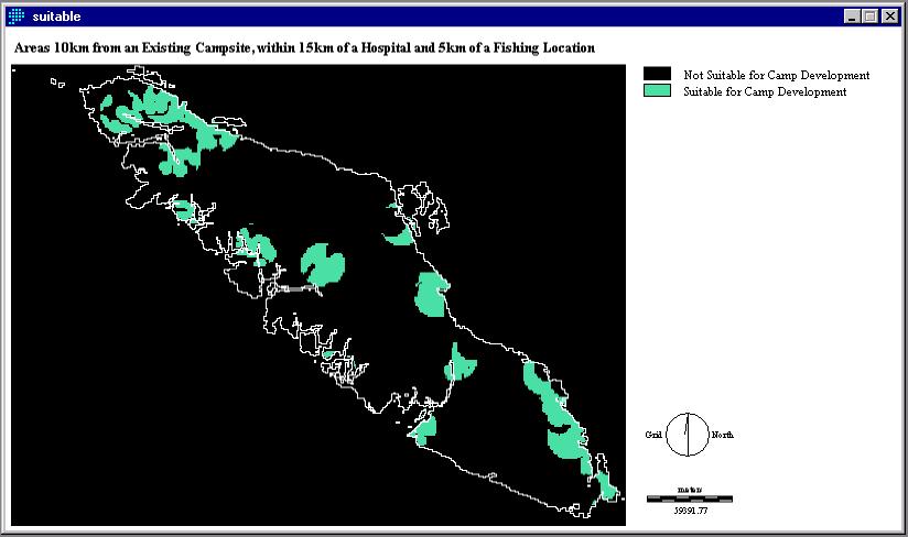
Figure 4 is the result of overlaying Figure 2, and a 5 km buffered image of fishing areas in a Boolean AND operation.
Fig. 4