
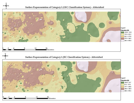
The graphical results for the two classification systems indicate significant similarities and some differences in the material distribution. Though the ranges of the elevation values are different, the two maps exhibit a common trend and a consistent pattern is evident on both maps. However, while GSC has over-represented the material in the -155.0 115.3 range, BC has also shown most of the material in the 259.9 390.4 range. Elevation changes are consistent despitedifferences in the elevation intervals of the two classification systems. This illustrates a consistent pattern in the classification rules adopted in each standardization system.


