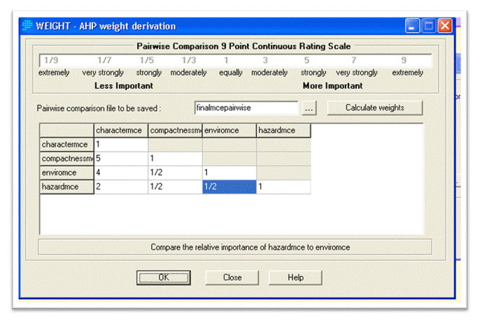
The results from the four component MCE analyses were combined using Weighted Linear Combination with the weighting below and the constraints were extracted at this point. The weighting used in the final analysis was biased towards environmental features and compactness, as these two interrelated objectives are most highly related to the desired goals outlined in the Bowen Island Official Community Plan (no net loss of farmland, preserving environmental ammenities, etc). Should the community adopt different values it would be possible adjust these WLC values to produce another, unique analysis.
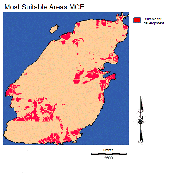
Most of the least suitable land for development as identified by the factors is in the areas of the island which have been subsequently covered by constraints. Crown land, for example, encompasses most of the most environmentally sensisitve areas, and is also the furthest from existing development. The land outside of the constraints varied in suitability scores from the mid range (125) to nearly 255. The final image was then reclassified to identify only the "Most suitable land", what was defined as having a suitability score of 240 or higher.

Several distinct areas emerge in the resultant image (below)--Snug Cove and surrounding area, Bowen Bay, and Cowen Point-- the relative merits and recommended policies for each are detailed in the "ISSUES" section of this page.

|

