Spatial Analysis
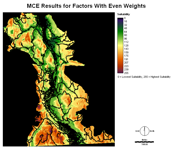
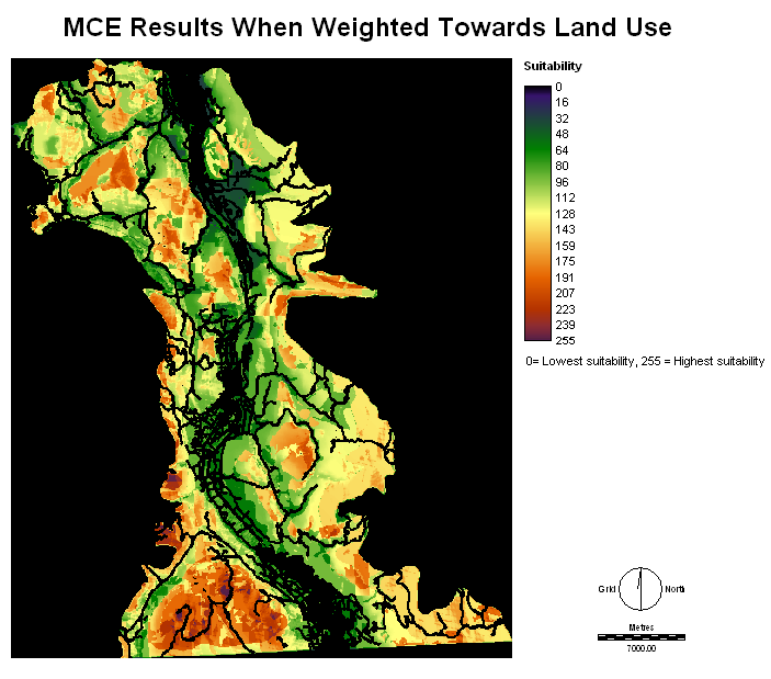
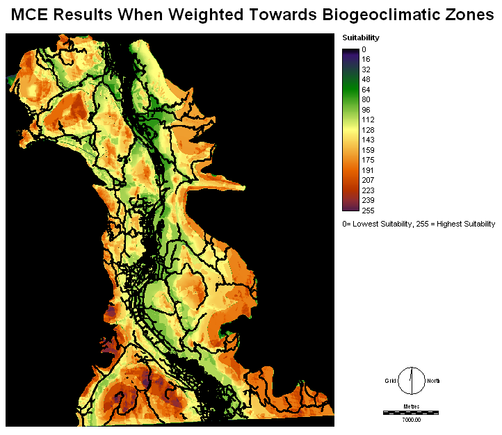
Once all of the factors were standardized and the constraints were set as Boolean images, the MCE could be preformed. Using MCE and the Weighted Linear Combination (WLC) factors and constraints were combined and it was possible to show the suitability of the ecosection for the reintroduction of the lily. This suitability depended on how factors were weighted against one another. Because this process is extremely subjective, a small sensitivity analysis was preformed to show how different factor weights can yield different suitability images. The first MCE preformed weighted the factors evenly. The second MCE was weighted towards the land use factor. The third MCE was weighted towards the biogeoclimatic zones. For each MCE, the Analytical Hierarchy Process (AHP) was used to help give a more realistic comparison of the factors. The AHP allowed for the relative importance of each factor to be compared with the importance another factor one at a time. For the rating scale associated with the AHP and the Pairwise Comparison, a scale is shown below each AHP table.
The first MCE preformed using the WLC set all factor weights to be equal. Because there are 5 factors, each factor was given a weight of 0.2000, since all weights must add up to 1. Because all weights were equal, there was no need to perform the AHP. The resulting suitability map can be seen below.
Aspect: 0.2000
Elevation: 0.2000
Lily Distance: 0.2000
Land Use: 0.2000
Biogeoclimatic Zone: 0.2000

Aspect: 0.1243
Elevation: 0.1243
Lily Distance: 0.1350
Land Use: 0.4276
Biogeoclimatic Zone: 0.1889
Consistency ratio = 0.07 (acceptable)
| Aspect | Elevation | Land use | Lily distance | Biogeoclimatic zones | |
| Aspect | 1 |
||||
| Elevation | 1 |
1 |
|||
| Land use | 5 |
5 |
1 |
||
| Lily distance | 1 |
1 |
1/3 |
1 |
|
| Biogeoclimatic zones | 1 |
1 |
1 |
1 |
1 |


Aspect: 0.1284
Elevation: 0.1284
Lily Distance: 0.1243
Land Use: 0.1894
Biogeoclimatic Zone: 0.4295
Consistency ratio = 0.06 (acceptable)
| Aspect | Elevation | Land use | Lily distance | Biogeoclimatic zones | |
| Aspect | 1 |
||||
| Elevation | 1 |
1 |
|||
| Lily distance | 1 |
1 |
1 |
||
| Biogeoclimatic zones | 4 |
4 |
5 |
1 |
|
| Land use | 1 |
1 |
1 |
1 |
1 |


