
Methodology
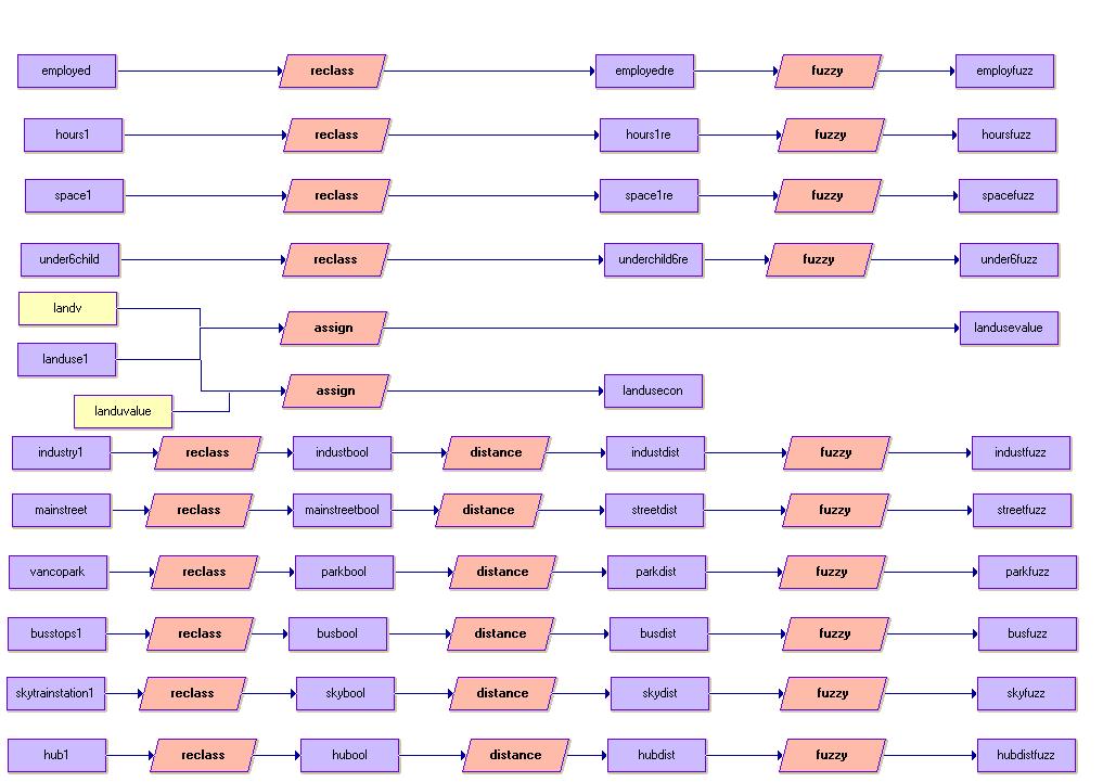
After the data were converted form vector to rastor, it was ready to perform a spatial analysis. In order to perform a multi-criteria evaluation (MCE), a set of constraints and factors were identified as below.Constraint:
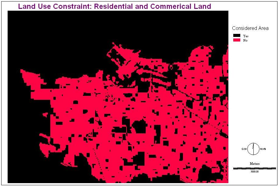
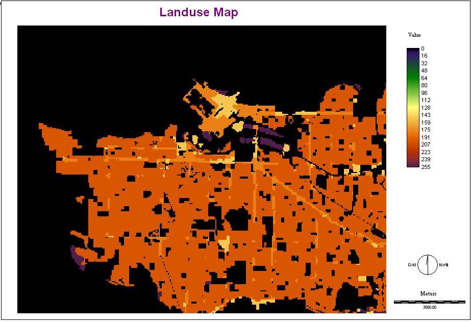
1. Located on residential and commerical land.
Only residential (sing family, townhouse and low rise apartment), commercial (both commercial and mixed use with residential), and open and undeveloped land are considered. High rise residential apartment was not considered because I thought it was not suitable site for a preschool. Boolean reclassification was performed so that only residential, commercial, open and undeveloped land that were considered for analysis have a value of 1 and other land use not for analysis has a value of 0. Map
Factors:
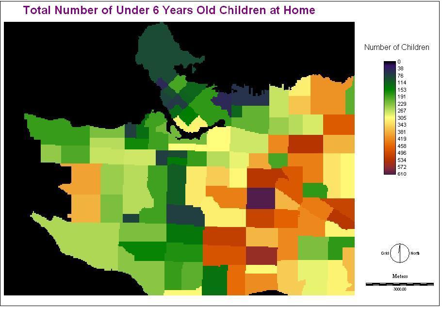
All factor files were reclassed first so that there would be no negative values. I performed Distance operation to some of them as described follow:1. Childen under 6 density.
Building a preschool site in a high children density area meets the need of most of the children. Map
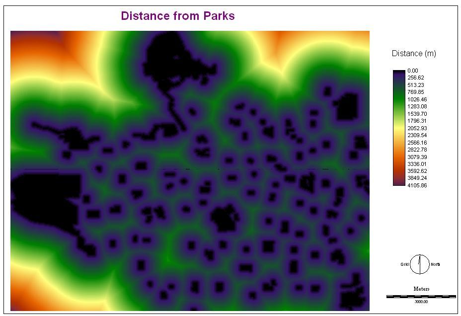
2. Distanc from park.
The Childcare Design Guidlines by the City of Vancouver suggests childcare facilities that should be built close to a park or playground to supplement a outdoor play area. Map I decided the bus stops should be best within 50 meters. The suitability decreases until 400 meters.
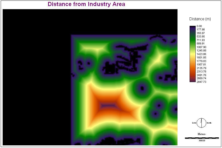
3. Distance from industrial area.
The Guidlines suggests that childcare facilities should be built far away from noise and pollution. Map I determined that the preschool should be built at least 300 meters away from industrial area.
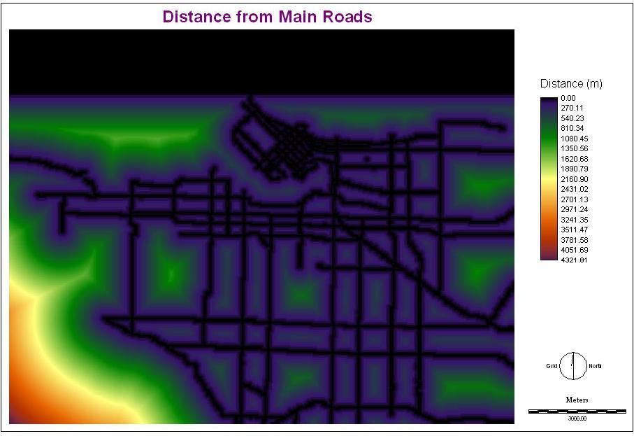
4. Distance from main streets.
Building a preschool near main streets alow people to get their easily as there are more traffic on main streets. Besides, the preschool will be more noticeable. Map I decided the bus stops should be best within 100 meters. The suitability decreases until 500 meters.
5. Land use.
The site should be on residential, commercial, and open land. The land use type that is more suitable has a higher value. I assigned a value of 255 for open and undeveloped land, 200 for residential land, 180 for commercial mixed use land, 150 for commercial land, and 0 for other land use. This value setting in a scale of 255 would not to standardize further when it was used in weight linear combination (WLC) since other fuzzy standardized images as shown below would have the same scale. Map
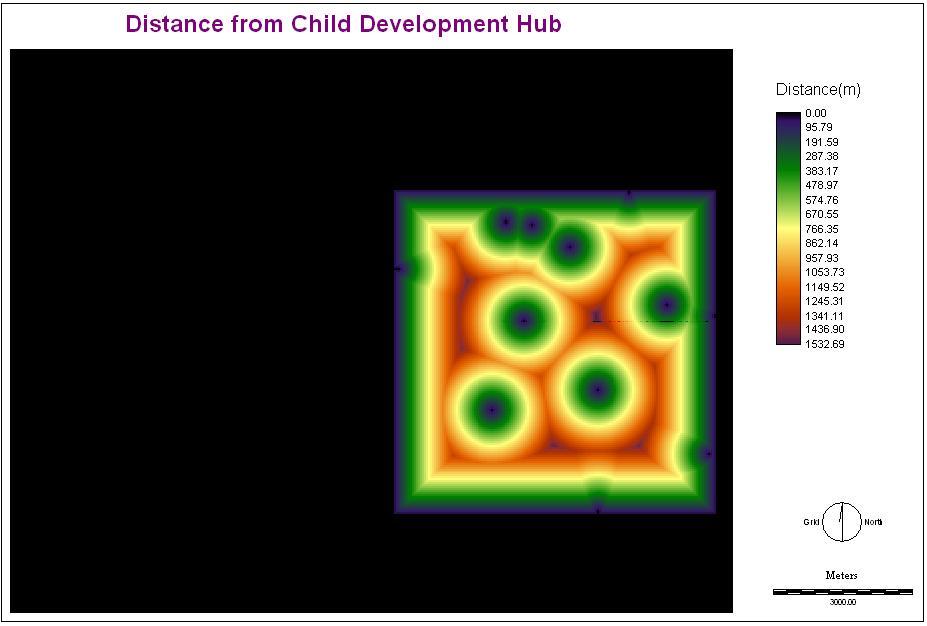
6. Child Development Hub.
The City of Vancouver promotes a concentration of childcare facilities, for this allows better cooperation between family services agencies and provides support to families. Thus, a preschool is best to locate in a hub. Map I decided the hub should be best within 100 meters. The suitability decreases until 400 meters.
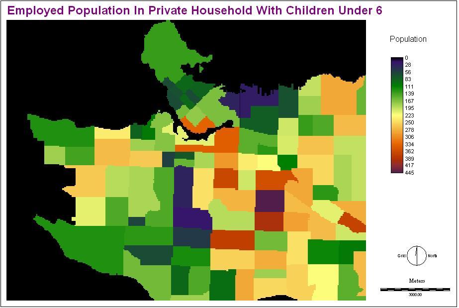
7. Employed population 15 years and over with children under 6.
Employed parents have a greater childcare need potential. Map
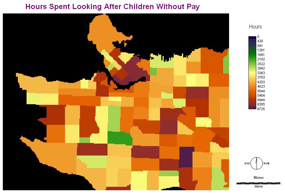
8. Population 15 years and over hours spent looking after children under 6 without pay.
One of the reasons more hours are spent to look after children is that the people may not have accessible childcare facilities close by. Map
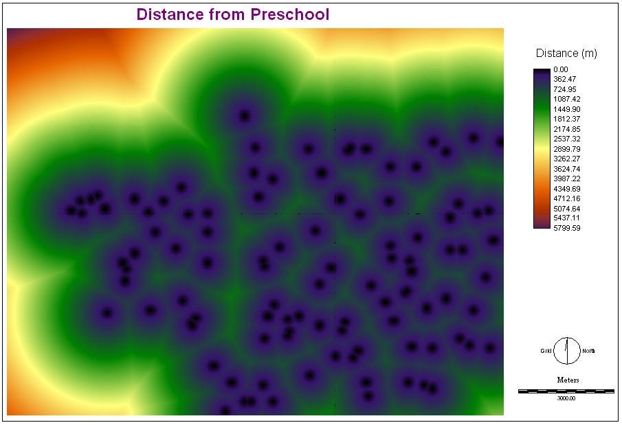
9. Preschool childcare space.
Having a certain amount of childcare space may fufill some of the childcare needs. Therefore, the preschool should be built where little or no childcare is available. Map
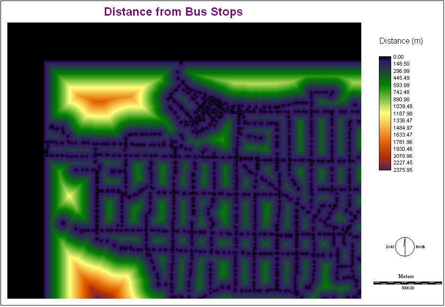
10. Distance from bus stops.
Building a preschool near bus stops allows more low-income people and people without cars to transport their children to the preschool by bus. Besides, the preschool will be more accessible to the public in general. Map I decided the bus stops should be best within 50 meters. The suitability decreases until 200 meters.
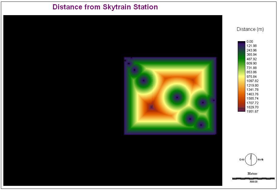
11.Distance from skytrain stations.
Having a preschool near a skytrain station enables parents living outside of Vancouver to gain a better access to the school. Map I decided the bus stops should be best within 100 meters. The suitability decreases until 800 meters.
After I identified the factors, I standardized them fuzzy into the same scale so that each criterion could be compared with each other.
| Factor File | Membership Function Shape | Membership Function Type | Control Points | Fuzzy Image File |
| under6childre | montonically increasing | Linear | a: 50; b: 610 | under6fuzz |
| parkdist | montonically decreasing | Sigmodial | c: 50; d: 400 | parkfuzz |
| industdist | montonically increasing | J-shaped | a: 300; b: 600 | landusevalue |
| streetdist | monotonically decreasing | J-shaped | c: 100; d: 500 | industfuzz |
| hubdist | monotonically decreasing | J-shaped | c: 100; d: 400 | streetfuzz |
| employedre | monotonically increasing | Linear | a: 100; b: 445 | employfuzz |
| hours1re | monotonically increasing | Linear | a: 500; b: 6725 | hoursfuzz |
| space1re | monotonically decreasing | Linear | c: 200; b: 162 | spacefuzz |
| busdist | montonically decreasing | J-shaped | c: 50; d: 200 | busfuzz |
| skydist | montonically decreasing | J-shaped | c:100; d: 800 | skyfuzz |
Reference List
City of Vancovuer. (1993). Childcare design guidelines. Retrieved November 21, 2006, from www.city.vancouver.bc.ca/commsvcs/guidelines/C017.pdf