Analysis Synopsis
Complete Technical Report
ß
|
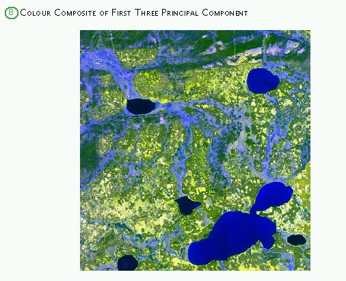
The image was viewed in different colour composites for bands 1,2,3 (visible spectrum), statistical bands
created from principal component analysis, and false colour images using the infrared band (4). The images
were enhanced to increase constrast between various land features and to maximize contrast between wetlands,
fens, and forests. Features were selected on enhanced image, identified, and compared to maps, aerial
photographs, oblique photos, and between different enhancement results. The principal components (1 to 3)
gave the best results. Of the two adjacent IKONOS images, one (west) was rejected due to cloud cover,
shadows, and haze. The East image was consequently selected for classification.
Training areas were located and drawn using references to ground truth data and photographs of the area.
The most homogeneous and representative areas for different land cover features were compared for spectral
characteristics and differences using scattergrams (spectral cluster analysis). Maximum Likelihood Enhanced
method provided supervised classification results, which were evaluated for errors against ground truth
data and other classification results. Through iterative process, the training areas were improved and
best classification results saved and exported to IDRISI for further analysis. Channel fens form a hydrological
network that links lakes and portions of the catchment area and are distinct from a complex pattern of small
disconnected wetlands.
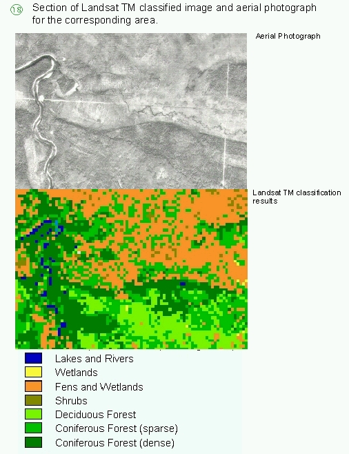
Colour and false colour composites were generated for different band combinations. Existing published
work for Landsat TM wetland classification provided a guide to optimum band choice and enhancement algorithms.
This project follows the procedures used by Wakelyn, 1990 in the Landsat TM classification of wetlands in the
Northwest Territories. Bands 2,4,5 were selected for classification. Different land features were identified
and compared to maps and air photos and IKONOS image of Scotty Creek basin.

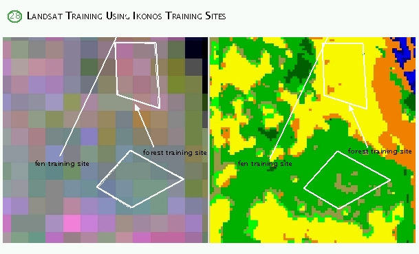
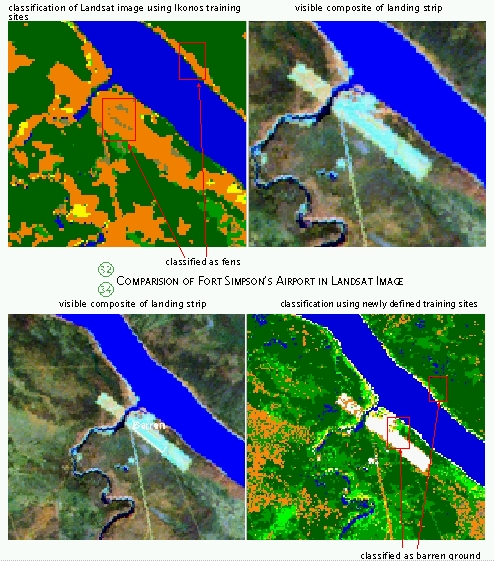
The Landsat TM image was initially trained for classification using the IKONOS classified image, but later
additional training areas outside of Scotty Creek basin were added and classification accuracy was improved.
Scattergrams show that wetlands, fens, and sparse coniferous forests are easily confused on Landsat TM image
due to overlapping spectral characteristics. Maximum Likelihood Supervised Classification method was used
and results were evaluated with IKONOS image, aerial photographs, and maps. The distribution of land cover
classes by area are similar to published work for northern wetland-dominated regions. The lower resolution
of Landsat TM image over the IKONOS image limits the use of Landsat data to general land-cover classification,
but not to detail connectivity evaluation of wetlands.
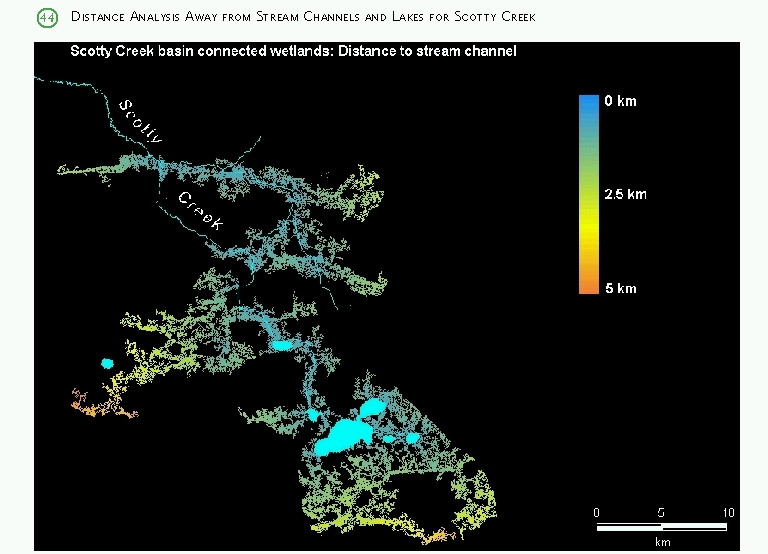
Using IDRISI raster images that were imported from Landsat TM image classification for Scotty Creek basin,
all distinct classes of land cover were separated, then overlay operations and image algebra and context
specific operations (i.e. Grouping) were applied to create an image of connected and disconnected wetlands.
Distances to drainage system were calculated for all pixels in connected wetland class based on cost-distance
analysis, where movement is allowed along connected wetlands only and unit cost is equal to unit distance.
Classified images (IKONOS and Landsat TM) were compared to ground truth site photos, small scale aerial
photographs, and in the case of Landsat TM image, compared to sections of classified IKONOS image.
However, the small spatial coverage of IKONOS image does not allow proper verification of all Landsat TM
image features, especially those not represented in Scotty Creek basin (barren land, ponds of different
depth, large deciduous stands, large fens that differ from those in the smaller basin). Qualitatively,
the classification results from high-resolution IKONOS image were very good, and all land features were
properly represented. The Landsat TM image classification had overall good representation of landscape,
but significant misclassifications occured in some areas and the magnitude of errors is difficult to
quantify without additional detailed ground truth data. The cross-classification between IKONOS and Landsat
TM images showed approximately 50% correspondence. Since many of the land cover features are very small
(wetlands, forest patches, ponds), the errors due to mixed pixels on medium resolution Landsat TM image are
the largest problem. These errors were visualized using IDRISI output.
|
