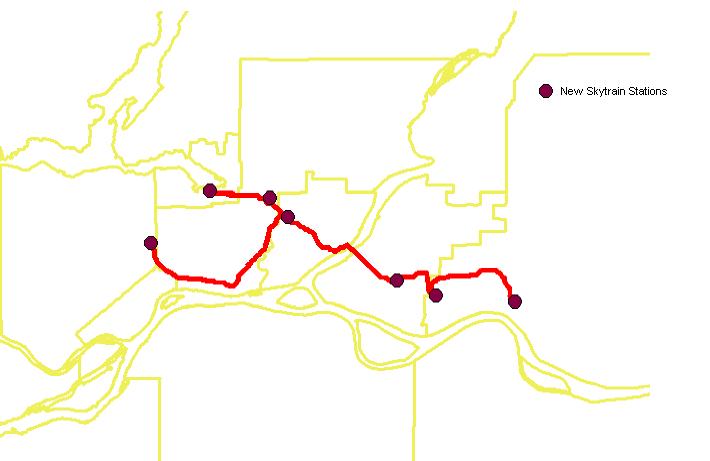
Once the track layer and the station layers were
all compiled with the Image Calculator and
then vectorized, they were overlaid in order to display the results
as the Final Map.
The new Skytrain line follows a fairly straight
path. This is a desirable outcome, making travel
times less. The only part that did not go according to plan was
that the path from Port Moody
to Lougheed Mall goes back to Coquitlam and then up to the Como Lake
area. Although it
is cheaper, it is not necessarily the most useful. Time is valuable,
something that the least cost
pathway does not take into account.
Also, if the pathway goes up into the Como Lake
area, it would make sense to build another
station to connect this region to the route.
Final Map
Back to Project Page
Back to INDEX