Methodology
[Main]
[Background]
[Outline]
[Analysis]
[Problems]
[Conclusion]
Essentially the method used to conduct this analysis was to create a population density raster surface and then use the least cost feature of Idrisi to find the best path for the a skytrain from downtown to the airport.
The data for this project was essentially just population data by enumeration area from the 1996 census and the vector file that had the area recorded for each enumeration area explicitly. Population data for individuals 15 years or over was used as it was assumed that this segment of the population would be the most active transit users.
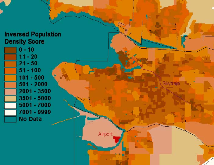
Population density was determined for each enumeration area in the vector file by dividing the population above 15 years by the area (in hectares). It was important to use density (instead of absolute population figures) so the data could be attributed to each raster cell in a meaningful way.
In order to allow dense areas to be favoured by the least cost function, the data was inverted (i.e. 1/x) so that dense areas would have low values, and sparsely populated areas would have high values. The values were then multiplied by 100 to increase there values above one. They were then transferred into an integer field to make all the values whole numbers (i.e., the decimal values were truncated).
(1 / x)*100
In this manner, the relative differences between values was maintained, though the actual values were altered to allow the analysis.
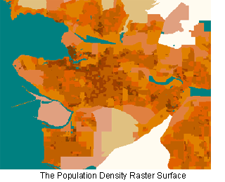 The vector coverage was then converted to a raster surface, with each enumeration area having homogenous population densities throughout. The least coast path was then calculated from both the Main Street skytrain station and the Burrard Station skytrain station to a point in Richmond adjacent to the airport.
Then a reclassification of the data in the vector coverage was done, where specific ranges of population density values were assigned arbitrary values. This vector coverage was then converted to a raster surface and the least cost path was obtained again. This created larger homogenous blocks of population density and eventually smoothed the least cost path. However, the reclassification was done several times to get meaningful and acceptable results.