Within IDRISI Kilimanjaro, the macro modeler and the decision making wizard are both used to derive the result of this spatial analysis.
The macro modeler was first used to change some of the dataset for the MCE.
All of the data needed to be reclassified either into Boolean format for constraint purposes or in a grade scale for factor analysis. Buffers were added to the stream, and road layers for proximity analysis and distance and fuzzy analysis tools were used on the power line layer to use as factors for decision making wizard.
In order for the data to be suitable for MCE, the data needed to be reclassified. All datasets needed to be reclassified either to 0 and 1 value for Boolean operations or on a sliding scale for factor analysis. The roads were manipulated with a 1 km buffer which makes all area within 1 km buffer suitable and all area outside of the buffer unsuitable. The streams are added with a 500m buffer which prohibits any development within the buffer zone.
The constraint layers include critical habitats, roads with a 1km buffer, streams with a 500m buffer, and coastline. All constraint layers are overlaid on top of each other to create the base layer with constraints that can be used for the decision making wizard. The decision making wizard does have an option to put in constraints, however, in this project all of the constraints were overlaid using the overlay option in the marco modeler.
The factors used for the MCE are the power lines with a distance of 1000m fuzzy, the density of threatened and endangered plants, and the amount of solar calories. Each factor was then compared with each other in terms of importance to develop a weight of each factor for the MCE.
Threatened Plants |
Solar |
Power Line |
|
Threatened Plants |
1 |
||
Solar |
7 |
1 |
|
Power line |
3 |
1 |
1 |
The Factor weights are as follows:
The eigenvector of weights is :
plantrec : 0.0975
solarrec : 0.5146
utilbuffrec : 0.3879
Consistency ratio = 0.07
Consistency is acceptable.
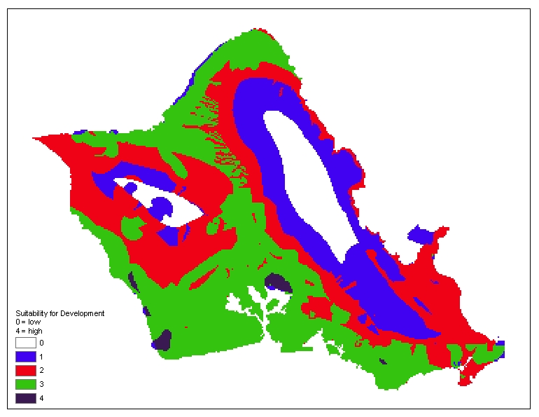
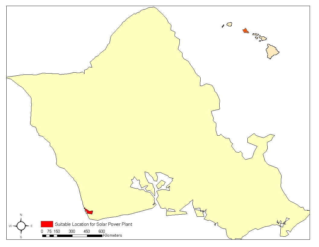
The decision making wizard output a map which shows area suitability based on a 0 to 4 scale, 0 is unsuitable and 4 is the most suitable. The initial results shows ten different areas that are the most suitable for solar power plant development based on the criteria used in the overlay process and the MCE decision making wizard. However, since the analysis only wants areas with an area larger than 100 hectares, the function of area is used to calculate the area of each separate parcel of land to determine which is the most suitable for solar power plant development. The result showed only one parcel of the land which fulfills this criterion.


