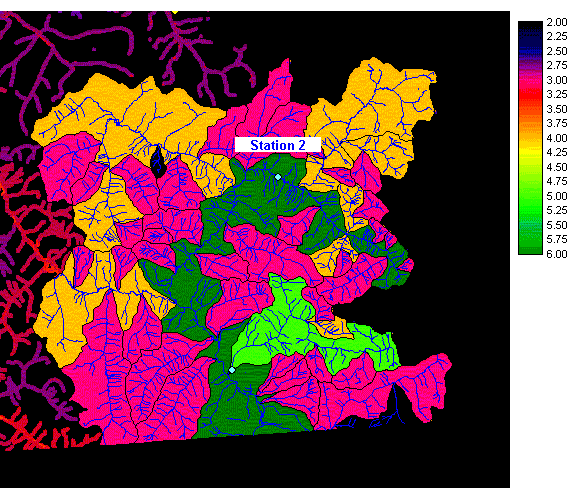
Figure 25a. Station 2, featuring watersheds.
Station 2 is also located in the extreme southeast corner of the Georgia Basin, just north of station 1. There are no existing hydrometric stations around it. Given its location on the river, it will encompass a watershed of stream order 5. This satisfies the under-representation of this stream order in the Fraser watershed group.
Figure
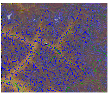
25b. Station 2, featuring terrain and roads.
Station 2 can be accessed by a two-lane paved road (green line). It is situated in a narrow valley that is not particularly well suited for a helicopter landing site.