| Conceptual Outline |
This project will include several types of analysis including buffering, digitizing, multiple criteria evaluations, weighted linear combination, statistical analysis of frictional values, and creation of data tables showing the magnitude and occurrences of earthquakes at each of the major cities on Vancouver Island as well as population densities. I will use such operations as edit, assign, reclass, overlay, conversion of coordinate systems, and conversion of data from vector to raster format.
Concerning Factors:
Distance From Lakes
The first step I took in deciding what type of information I needed was to consider where the greatest amount of damage usually occurs when an earthquake hits. For instance, I know that it is unsafe to live near any large water body such as a lake or ocean because earthquakes can cause large tidal waves, referred to as tsunamis, which can flood large areas of low lying land surrounding them. As a result I chose to create a 2km buffer around all major lakes on Vancouver Island.
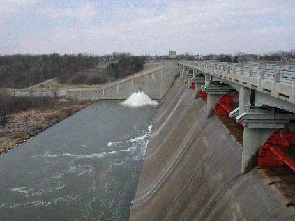
Distance From
Dams and Hydrolines
| In connection with this it will also be dangerous to live near a dam because should the dam break due to the vibrations caused by the earthquake, all of the water it is holding back will cascade into the valley and cause severe flooding, property damage and death. Hydrolines will therefore be even more dangerous if major flooding results during an earthquake because electricity will run through the water creating intensive electrical currents which will kill anyone in contact with that water. I chose to create a 5km buffer around all of the dams, and an even larger 7km buffer around all hydrolines on the Island. |
 |
|
|
Distance From Major Roads
Proximity of a particular area to major road systems is also an important factor to consider during an earthquake because fast, efficient methods of evacuation are critical at times such as this. In addition it is important to be near more than one major highway in case something should happen to one of the highways during the earthquake, such as the road forming cracks and becoming unsuitable to drive on. I decided to create a 1.5km buffer from all major roads.
Slope
Through my studies in physical geography I have learned all about the effects of mass wasting and how certain types of mass wasting such as landslides and debris flows can be easily triggered by the shaking from an earthquake. I have therefore decided that as part of my spatial analysis it will be important to consider the degree of slope in an area to determine how susceptible it might be to mass wasting. I have determined that a slope less than 10 degrees will be sufficiently safe, whereas any areas with a slope of 10 degrees or greater will be considered unsafe during an earthquake due to the increased potential of slope failure.
Existing Constraints:
Population Density
The population density in an area is a major concern during an earthquake.
Very highly populated areas such as major cities will receive extensive
damage due to the fact that they usually contain many highrise buildings
which are more at risk for pancaking (collapse of upper storeys) during
an earthquake. As well, the sheer volume of inhabitants will make
evacuation from the area very slow and difficult, at a time when every
second is crucial for safely fleeing the area.
I found data showing the population of each of the major cities on Vancouver
island and entered it into a datatable in Idrisi by hand to show which
areas are the most dangerous and therefore best to live distant from.
I did however, when performing analysis, take into account the fact that
an individual living on Vancouver Island would not want to live too distant
from a major city for convenience reasons. They will probably need
to make several trips into and out of the city to run daily errands and
buy food. Therefore I have decided that the most suitable location
to live with regards to a major city would be between 5 and 100 kilometres
away from a city. Any closer or more distant than this would be be
putting yourself at a considerable risk or inconvenience.
Landuse
In my analysis the major constraint for living in the safest place on Vancouver Island during an earthquake is determined by the type of landuse. Certain areas, such as lakes, oceans, mature forests, logged areas, wetlands, alpine and ice fields are considered unsuitable for living in, while others such as urban, barren, agricultural lands or recreational areas are more suitable. I created a constraint map to clearly show the suitability of each of the above factors to help determine a more suitable place to live.