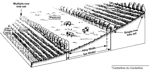
The figure below shows the general view and the structure of an alley farm
i)
The physical and chemical reaction between trees and crops.
ii)
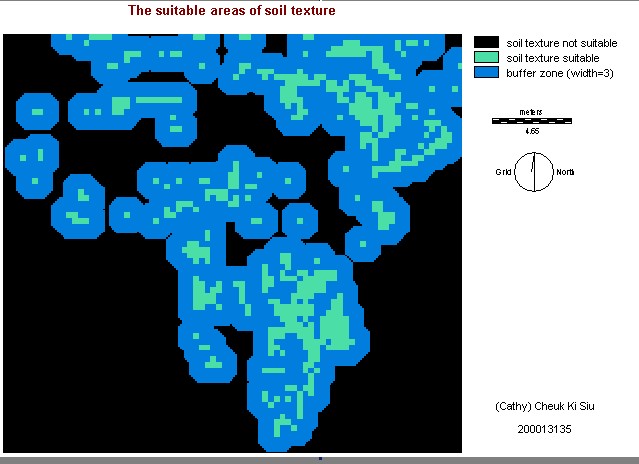
The soil texture that is suitable for both crops and the trees
iii)
The degradation of soil.
iv)
The overgrazing of the soil
v)
The water erosion
vi)The
land or forest type
Since alley farming system can prevent the water and soil from serious degradation, the alley farming should be practised on the areas that the soil and water degradation are in low or moderate regions. Then , these regions would not become highly soil and water eroded. Alley farming system can also improve the soil texture of the overgrazed regions, so it can also practise on the overgrazed areas. The land or forest types have to compromise with the crops and the trees.
For planning an alley farm, there are several procedures:
i)
Alley width
ii)
The orientation of the belts
iii)
The locations of the alley farm
iv)
The width of belts
Single or mutiple rows of trees is planted along the sideways of the crops. The spacing between the sets is depended on the types of crops. For the control of erosion, the spacing of trees and crops should be less, so the roots of trees can minimize the erosion. Pecan, black walnut and northern red oak are often chosen for the tree species. There are 4 groups of crops that are suitable for planting with those tree species : row/cereal crops (eg, corn, wheat), forage crops (eg, fescue, orchard grass), specialty crops (eg, spruce, dogwood) and biomass crops (eg, poplars, willows).
The figure below shows the general view and the structure of an alley farm
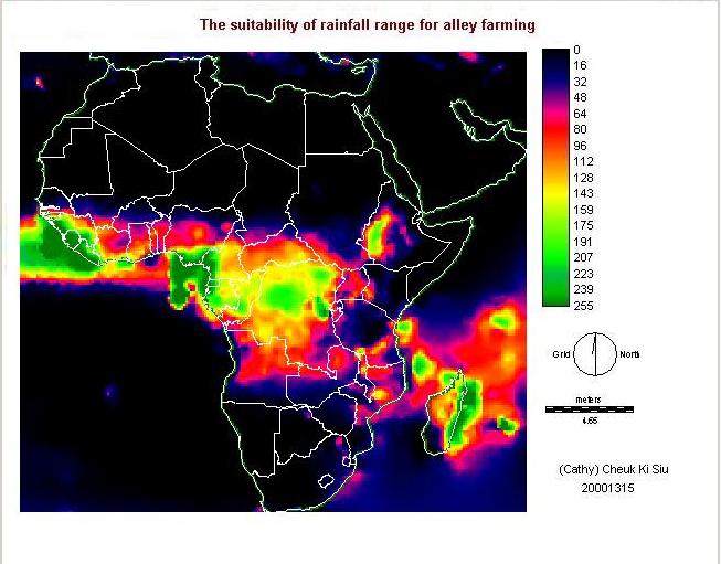
I have produced 4 maps, the suitability of alley farming in Africa (allfarmwlc.alleywlc),
the suitability of soil texture (soiltexbuff),
the suitability of precipitation range (rainfuzz)
and the physical and chemical deterioration (phychemdet).
 Want
to go back to index?? click here
Want
to go back to index?? click here
Go next??click here