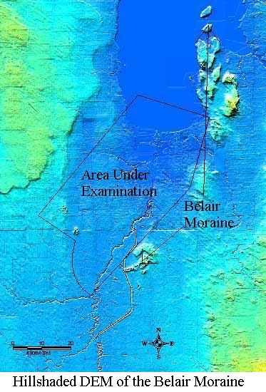
Introduction to the Belair Moraine:
The Belair Moraine is located in southern Manitoba and consists of several discontinuous ridges from 30 to 50m in elevation of stratified gravel and sand which arc southward for about 100 km from Lake Winnipeg to the city of Winnipeg. The processes by which it was deposited have yet to be fully understood. It is believed to have been deposited as a grounding line moraine, which means it was deposited at the head of an ice mass. The ice mass from which it is thought to have been deposited likely receded to the north-west, leading to an examination of subsurface stratigraphy and patterns in this direction in order to determine to processes and patterns by which it was deposited.Local Stratigraphy:
The Belair Moraine is located in a flat clay plain which was deposited at the end of the last glaciation by glacial lake Agassiz. This lake formed along the edge of the Laurentide ice sheet where it blocked drainage to the north. At the contact between this lake and the ice, meltwater from the glacier deposited vast amounts of sand and gravel in a series of coalescing sub-aqueous (underwater) fans. These fans built up and formed the Belair Moraine.Hypothesis:
Subsurface sand and gravel which is located in a specific stratiagraphic sequence, (ie. clay at the surface with gravel and sand directly under it) is thought to show the location of meltwater transport during the last glaciation. By examining the distribution of these deposits one can theoretically determine the spatial pattern of deposition of the Belair Moraine. In this analysis the density of data, proportion of boreholes containing the specific stratiagraphic sequence of sand and gravel, and the thickness of the sand and gravel units will be used to evaluate the spatial pattern of the deposits given the low quality of the data (see data collection).