 Methodological
and Operational Problems
Methodological
and Operational Problems
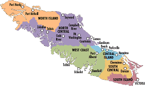
Due to the vast numbers of camping venues on Vancouver Island, I constrained my analysis to provincial campsites. To produce a more complete analysis of the area, privately owned campsites should have been included. The provincial campsites included in this analysis are not inclusive of all provincial campsites on Vancouver Island. The map I used to digitize campgrounds did not contain all of Vancouver Islands' campgrounds. Although I had a list of all campgrounds and their addresses, the roads layer did not include road names and so their precise locations were impossible to determine with the data that I had. Unfortunately, the Vancouver Island image provided by the Vancouver Island CORE Landuse Plan (VANISLE) did not include the islands surrounding Vancouver Island. These islands contain many provincial campsites. The omission of these islands produced a problem with digitizing existing campgrounds, however the inclusion of major roads (on the M_ROADS layer) on these smaller islands made digitizing campsites slightly easier.
This analysis' major problem is a result of digitizing hospital and campground location. Their locational accuracy is questionable and any operation performed on these layers, as well as all operation performed after, are increasingly inaccurate due to digitizing error (error propagation).
Another major problem with this analysis (and with most) is that the entities were modeled with exactly defined entities with restrictions that were unable to deal with uncertainty, complexity, and vagueness in terms of fuzzy logic.
Other operational problems may have occurred through the determination of slopes from a Digital Elevation Model. Since DEMs are secondary data reconstructed form data at sample locations or remotely sensed imagery there may be measurement and/or interpolation error.
I encountered an operational problem when I tried to vectorize polygons using the raster/vector conversion tool, POLYVEC. The polygon would be in the form of a line and when I tried to fill the polygon, the entire layer would be filled. This was due to the vectorization of the boundaries of the raster image. Reluctantly, I could only use the vectorized polygon for display purposes.
I think that this analysis would have been better suited to a smaller region. I was limited to the data available to me and an analysis of a smaller region would have required a larger resolution and more comprehensive data on landuse and parks. These changes would have produced a more realistic derivation of the location of a new provincial campground.