
 Methodology
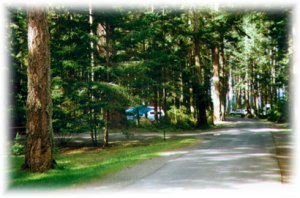
Camping is a popular summer
weekend retreat. Most provincial campsites fulfill their carrying capacity
on long weekends. This crowding has forced some provincial campgrounds
to allow reservations for their campsites. Reservations are made through
BC
Parks. The new campground would ideally be located greater than 10
km from any existing site to reduce crowding, and any impacts this would
have on the environment.
Provincial campgrounds vary in size from about 20 sites to greater than 150 and most camping venues (private and public) inhabit an area of about 0.5 km2. Since the resolution of the data was at 1000m I decided to make the minimum size of my area 2 km2. I digitized provincial campground locations and used BUFFER to create a 10 km distance around existing provincial campsites and later GROUP, AREA, and RECLASS to determine that suitable areas were large enough for campground development.
An unlikely although important aspect to campsite location is the proximity of a hospital. The activity associated with camping can be dangerous and the location of a hospital is usually provided in camping and tourism books and magazines. I therefore included hospitals in my analysis by digitizing their locations. I excluded areas greater than 15 km from a hospital from my analysis.
Recreational activity is a major attraction for most campgrounds. The ideal site would have access to fishing, hiking, walking and natural appreciation areas. Fishing and boating are amongst the most popular activities undertaken by campers. Natural appreciation areas provide a space for bird watching, and scenic enjoyment. By overlaying fishing lakes, streams, and rivers, I produced a layer for fishing areas. These fishing areas only benefit campers if they are located near the campsite and so locations that were greater than 5 km from a fishing area were unacceptable for camping. The presence of boat launches are crucial for fishing and a restriction of 5 km was also placed around boat launches. Hiking and walking trails were also overlain in the same manner. Hiking, walking, and natural appreciation are activities carried out by foot so a distance of 2 km was placed around trails and natural appreciation areas. Producing the best locations for a new campground.
Wetlands, urban areas, alpine, agriculture, and ice fields are areas that are not appropriate nor available to development. These areas were avoided in this analysis through the reclassification of landuse data. Hazardous flood zones, protected watersheds, and unappealing dam sites and coal basins were avoided in this analysis through reclassification, buffering, and multi-criteria evaluation.