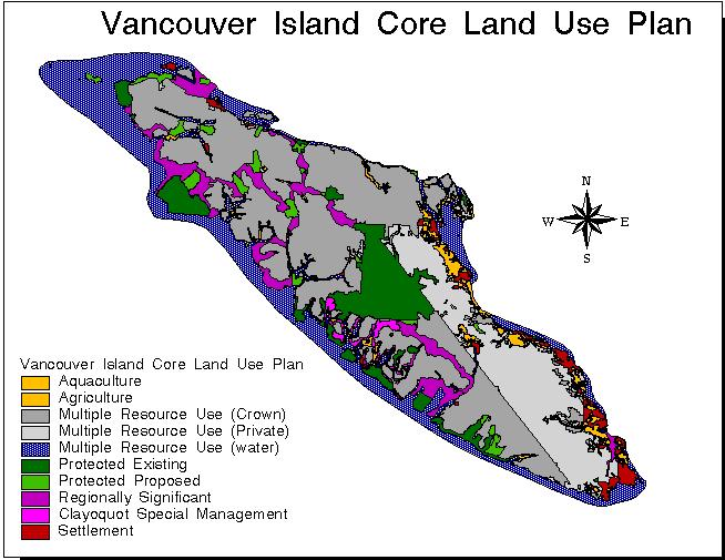
Data was acquired from several sources in this analysis. Some data was digitized into Idrisi by hand. This includes the location of existing hospitals (HOSPITAL), and provincial campsites (CAMPING) on Vancouver Island. I digitized these layers from a BCAA Rand-McNally roadmap of Vancouver Island; 1999/2000 edition at a scale of 1:36,000. Other data was collected from the Vancouver Island CORE Landuse Plan at a resolution of 1000. Some data on the Vancouver Island CORE Landuse Plan was available in Idrisi format on the S:drive in Simon Fraser University's Spatial Information Systems (SIS) Lab. This includes FISHLAKE, FISHSTRM, LANDUSE, EPAVIWTR, M_ROADS, COALBASN, and DAMSITE. Other data was acquired in ArcInfo format on the Vancouver Island CORE Landuse Plans' homepage (http://www.gis.luco.gov.bc.ca/slup/vanisle.html). All data in ArcInfo format had to be converted for use in Idrisi32.
The converted data includes FISHRIV,
FLDHAZVI, HIKING, WALKING, LAUNCH, and
NATAPRN. The conversion process involved converting ArcInfo .E00
datafiles into .mdb datafiles that are readable in ArcView3.2. Once the
data was imported into ArcView using IMPORT71, the data had to be converted
into ArcView shapefiles (.shp). This was done using "Convert to Shapefile"
in the THEME menu. Once data was converted into shapefiles, they were imported
into Idrisi using "Import - Software-Specific Format - SHAPEIDR". The reference
system is plane, and the reference units are in meters.
Data used in this analysis:
| CAMPING | Provincial Campsites |
| COALBASN | Coal Basins |
| DAMSITE | Dam Site |
| EPAVIWTR | Environmental Protection Areas - ProtectedWatersheds |
| FISHLAKE | Fishing Lakes |
| FISHRIV | Fishing Rivers |
| FISHSTRM | Fishing Streams |
| FLDHAZVI | Flood Zones |
| HIKING | Hiking Trails |
| HOSPITAL | Hospitals |
| LANDUSE | Landuse |
| LAUNCH | Boat Launch |
| M_ROADS | Major Roads |
| NATAPRN | Natural Appreciation Areas |
| WALKING | Walking Trails |