Part Four:
Transport Networks
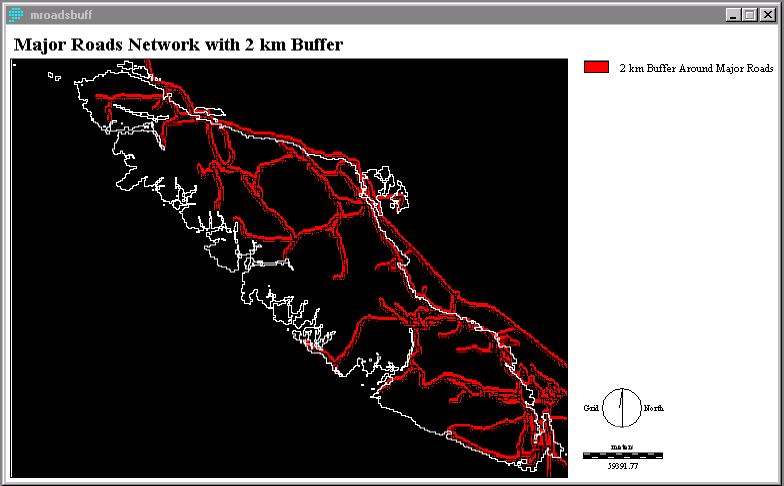
A major roads network is important to campsite
location. Most campers travel long distances and campsites must be easily
accessible with good signage to attract campers. I created a 2 km buffer
around major roads so that the roads would not be visible/audible from
the campgrounds, and so they could be easily accessed from the campgrounds.
The buffer is displayed below, MROADSBUFF (fig. 13).
Fig. 13
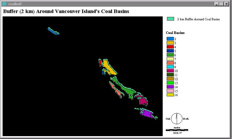
Many coalbasins are located on Vancouver Island. These areas should be avoided in the development of a campsite. COALBASN, a vector layer, was rasterized using POLYRAS, RECLASSed and then BUFFERed with a 2 km buffer to create the image below, COALBUFF (fig. 14).
Fig. 14
NO_ROADS1 (fig. 15a & fig. 15b) is an image created by the OVERLAY (subtract) operation and then the RECLASS of NOCOAL1 and MROADSBUFF (fig. 13). The areas in green are the most suitable areas for camp development according to all of the data up to this point. An enlargement of the three suitable areas is seen in figure 15b.
Fig. 15a
Fig. 15b
