 Spatial
Analysis and Results
Spatial
Analysis and Results
Spatial
Analysis and Results
Spatial Analysis
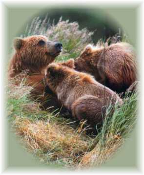
Constraints:
The only constraint employed in this
assessment of Grizzly Bear habitat suitability is water-based. The assumptions
here are:
1. Grizzly Bears are land-based
and thus do not live in water.
2. Virtually any land area is possible
Grizzly Bear habitat, but the qualities of these areas differ. BTMs were
used to create
Boolean maps of ocean and fresh
water systems including lakes, reservoirs and wide portions of major rivers
called WATERCON using RECLASS. This was used to mask out from the study
area.
Factors:
1) Proximity to Fresh Water Bodies
All living organisms cannot live
without water, Grizzly Bears are no exception. DISTANCE operator was used
in IDRISI to perform distance operation
to fresh water sources (BTMs). The resulting map WATERDIST was then
fed through the FUZZY operation
and mapped with sigmoidal monotonically decreasing function to habitat
suitability. Habitat suitability
decreases sigmoidally from 150 metres to 1000 metres and then, above 1000
meters
it becomes equally unsuitable.
2) Slope
Prime Grizzly Bear habitat is located
in the gentle sloped valley bottoms close to fresh water sources. SURFACE
operation calculated slopes from
the Digital Elevation Models (DEMs), the result was fed through FUZZY with
monotonically decreasing linear
relationships, parameters 0 degree and 30 degree indicating the most suitable
areas
with slopes below 30 degrees.
3) Elevation
Grizzly Bears generally stay below
the tree line, where food and water is more abundant. DEMs were used to
map
linear decreasing relationship between
elevation and habitat suitability, with parameters 150m and 1000m using
FUZZY indicating the areas above
1000 meters as equally unsuitable.
4) Land Cover
The 19 land-use classes determined
by the Ministry of Environment used here were reclassified based on the
literature review findings from
various Grizzly Bear habitat studies. Forests were given the highest rating,
with
Old Growth topping the list as prime
Grizzly Bear habitat at maximum suitability of 255. Areas with human
activities/settlements were given
lowest scores accordingly. Less ideal natural habitats like alpine/glaciers
were
also given lower scores.
5) Proximity to Human Activity
Human activity sites like recreation
sites, ski resorts and golf courses are not ideal Grizzly Bear habitat.
But this is
more tolerated than permanent/long
term human settlements. DISTANCE & FUZZY operations were performed
with a minimum distance of 370 meters
from the human activity sites.
6) Proximity to Human Settlements
Grizzly Bears will change its’ behaviour
around humans. This is a rather complex relationship that we shall generalize
as Proximity to Human Settlements.
That is, habitat suitability increases further away from human contact.
This factor
was given different parameters as
permanent/long term human contact has a greater impact on Grizzly Bears
than
short-term human activities. DISTANCE
& FUZZY operations were performed indicating 1000 meters as a
minimum distance from human settlements.
7) Proximity to Old Forest
The Central Coast of British Columbia
is known to sustain large numbers of Grizzly Bear populations because of
its’ relatively intact temperate
rainforests, one of the largest in the world. This supports the hypothesis
that Grizzly
Bears thrive in Old Forests. This
is the consequence of old forests having spatial and structural complexities
that are
lacking in the young/plantation
forests. These create micro/macro habitats within the forests that encourage
bio-diversity.
Also, from a conservation point
of view, we would like to see more of the Great Bear Rainforest protected.
DISTANCE & FUZZY operations
were performed to show that the suitability decreases as the distance from
old
forest increases.
Multiple-Criteria Evaluation:
Weights were calculated with the
pair-wise comparison matrix for all factors:
| Water | Slope | Elevation | Oldfor | Humactiv | Humsettl | Forest | |
| Water | 1 | ||||||
| Slope | 1/3 | 1 | |||||
| Elevation | 1 | 1 | 1 | ||||
| Oldfor | 1/3 | 1/3 | 1/5 | 1 | |||
| Humactiv | 1 | 1 | 1 | 5 | 1 | ||
| Humsettl | 1 | 1 | 1/3 | 3 | 1/3 | 1 | |
| Forest | 1/3 | 1/3 | 1/3 | 1 | 1/3 | 1/3 | 1 |
IDRISI is rather inflexible with
the pair-wise comparison values in the matrix because it
does not allow entering custom weight
ratios. Multiple Criteria Evaluation was performed as the final step towards
Grizzly Bear habitat suitability
map and then, this final map was reclassified to highlight only the
high quality
grizzly bear habitats.
Grizzly Bear
Habitat Suitability Assessment Map
High Quality
Grizzly Bear Habitat Map
Results
Primarily, our analysis was focused
on eight watersheds located in the central coast of British Columbia. The
main
assumptions drawn from the analysis
indicate that the most suitable watershed in the this region is Kitasu
River
watershed, while Bela Coola River
watershed was recognized as the least suitable. However, the viability
of these
watersheds depends upon many factors
highlighted here and their suitability index may serve only as a qualitative
measure.
Grizzly Bear Habitat Suitability by Watershed Map
Below is the table that shows the
final quantitative results of our analysis. Initially, the original area
of each watershed was calculated and then, the high quality habitat areas
(>200) were added. Then, all watersheds were ranked based on these
calculations. As we can see, Kitasu Bay and Laredo Inlet watersheds have
the highest percentage of high quality habitat,
whereas Owikeno Lake and Bella Coola
River watersheds have the lowest percentage.
| Watershed Name | Watershed Area (sq.km) | High Quality Habitat | Rank by Total Area | % Area High Quality | Rank by % |
| BELA | 2490.47375 | 24.11625 | 8 | 0.968339859 | 8 |
| KHTZ | 3497.319553 | 167.8818784 | 7 | 4.80030137 | 6 |
| KTSU | 943.0636249 | 418.6441207 | 4 | 44.39192751 | 1 |
| LRDO | 2342.905874 | 538.2725611 | 1 | 22.97457047 | 2 |
| NASC | 4134.018106 | 492.2812549 | 2 | 11.90805754 | 4 |
| NECL | 3340.174086 | 475.0470068 | 3 | 14.22222299 | 3 |
| NIEL | 3864.125694 | 352.6433751 | 5 | 9.126084476 | 5 |
| OWIK | 8293.673125 | 230.879375 | 6 | 2.783801236 | 7 |
However, the Bella Coola River watershed should not be ignored based on its low degree of suitability. It is clearly visible that this watershed serves as a corridor to the more remote watersheds located northward and therefore, it provides a good quality habitat for grizzly bear. Moreover, the supervised classification used in our analysis was arbitrary and focused on high quality habitats, but it does not suggest that lower suitability habitats should be ignored.
When considering the ranking based
on the total area of high quality habitat, we recognize the Laredo Inlet
and Nascall River watersheds as the most viable habitats, while Khuze River
and Bella Coola River watersheds belong to the least suitable habitats.
Generally, the habitat suitability
depends on the size of watersheds and their location, so that
larger watersheds situated closer to the coast have higher suitability
level. Even though the Kitasu Bay watershed is relatively small, its remote
location on the coast has a significant impact on its suitability.
The general trend observed indicates
that the suitability of the watersheds decreases as they are farther inland.
Moreover, the high quality habitats become smaller and fragmented in the
watersheds located farther from the coast. However, the linkage to other
watersheds is clearly observed mainly through the major rivers and more
frequently, through the dense network of smaller streams farther inland.


![]()